METAR-TAF
Airports :
Los Angeles
Avalon
Burbank
Camarillo
Campo
Carlsbad
Chino
Corona
El Monte
Fullerton
Hawthorne
Imperial Beach
Lancaster
La Verne
Long Beach
Los Alamitos
Los Angeles
Los Angeles
Los Angeles
Mount Wilson Observatory
Oceanside
Oceanside / Camp Pendleton
Ontario
Oxnard
Palmdale
Palm Springs
Point Mugu
Ramona
Riverside
Riverside
San Bernardino
San Clemente
Sandberg
San Diego
San Diego
San Diego
San Diego / El Cajon
San Diego / Miramar
San Diego / North Island
Santa Ana
Santa Monica
Tijuana
Torrance
Van Nuys
Victorville
California, Los Angeles, San Diego
California, South
Mexico, Northwest
Los Angeles International Airport Los Angeles, California, United States
latitude: 33-56-17N, longitude: 118-23-20W, elevation: 125 ft
Current weather observation The report was made 48 minutes ago, at 06:53 UTC
Calm wind
Temperature 61 °F
Humidity 88 %
Pressure 30.07 in. Hg
Visibility: 10 miles
Few clouds at a height of 1000 ft Scattered clouds at a height of 25000 ft
METAR: KLAX 260653Z 00000KT 10SM FEW010 SCT250 16/14 A3007 RMK AO2 SLP182 T01560144
Time: 23:41 (07:41 UTC) Forecast The report was made 1 hour and 59 minutes ago, at 05:42 UTC
Forecast valid from 26 at 06 UTC to 27 at 12 UTC
Wind 7 mph from the West/Southwest
Visibility: 6 miles
Scattered clouds at a height of 25000 ft
From 26 at 1200 UTC
Wind 3 mph from variable directions
Visibility: 0.5 miles
at a height of 200 ft
fog
From 26 at 1600 UTC
Wind 3 mph from variable directions
Visibility: 5 miles
Broken clouds at a height of 400 ft
mist
From 26 at 1700 UTC
Wind 7 mph from the West/Southwest
Visibility: 6 miles
Scattered clouds at a height of 25000 ft
From 26 at 2000 UTC
Wind 14 mph from the West
Visibility: 6 miles
Scattered clouds at a height of 25000 ft
From 27 at 0400 UTC
Wind 7 mph from the West/Southwest
Visibility: 6 miles
Scattered clouds at a height of 25000 ft
From 27 at 0800 UTC
Wind 3 mph from variable directions
Visibility: 6 miles
Scattered clouds at a height of 25000 ft
TAF: KLAX 260542Z 2606/2712 25006KT P6SM SCT250 FM261200 VRB03KT 1/2SM FG VV002 FM261600 VRB03KT 5SM BR BKN004 FM261700 25006KT P6SM SCT250 FM262000 26012KT P6SM SCT250 FM270400 25006KT P6SM SCT250 FM270800 VRB03KT P6SM SCT250
Weather observations and forecasts of more than 4000 airports (METAR and TAF reports).
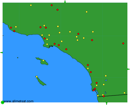
The available stations are represented by yellow and red dots on the map.
Hover mouse over dot to see the name of the station.
Then click to see weather observations and forecasts.
To change the map : click on the green buttons with a black cross to zoom in, on the green button with a dash to zoom out, or on the green arrows for adjacent maps.
