METAR-TAF
Airports :
Yakubu Gowon Airport
Jos, Nigeria
latitude: 09-52N, longitude: 008-54E, elevation: 1295 m
METAR: missing
Time: 03:52 (02:52 UTC)
Forecast
The report was made 15 hours and 52 minutes ago, at 11:00 UTC
Forecast valid from 01 at 12 UTC to 02 at 18 UTC
Wind 15 kt from the West/Southwest
Visibility 10 km or more
Broken clouds at a height of 800 ft
Temporary
from 01 at 14 UTC to 01 at 19 UTC
from 01 at 14 UTC to 01 at 19 UTC
Wind 10 kt from the East/Northeast
Broken clouds at a height of 800 ft
Few clouds at a height of 1800 ft, Cumulonimbus.
Few clouds at a height of 1800 ft, Cumulonimbus.
Becoming
from 01 at 19 UTC to 01 at 21 UTC
from 01 at 19 UTC to 01 at 21 UTC
Wind 2 kt from variable directions
Scattered clouds at a height of 600 ft
Temporary
from 02 at 03 UTC to 02 at 08 UTC
from 02 at 03 UTC to 02 at 08 UTC
Broken clouds at a height of 600 ft
mist
Becoming
from 02 at 08 UTC to 02 at 11 UTC
from 02 at 08 UTC to 02 at 11 UTC
Wind 12 kt from the West/Southwest
Broken clouds at a height of 800 ft
TAF: DNJO 011100Z 0112/0218 25015KT 9999 BKN008 TEMPO 0114/0119 07010KT 5000-TSRA BKN008 FEW018CB BECMG 0119/0121 VRB02KT SCT006 TEMPO 0203/0208 5000-RA BR BKN006 BECMG 0208/0211 24012KT BKN008
Weather observations and forecasts of more than 4000 airports (METAR and TAF reports).
The available stations are represented by yellow and red dots on the map.
Hover mouse over dot to see the name of the station.
Then click to see weather observations and forecasts.
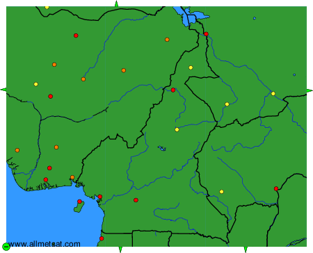
To change the map : click on the green buttons with a black cross to zoom in, on the green button with a dash to zoom out, or on the green arrows for adjacent maps.