METAR-TAF
Airports :
Bata Airport
Bata, Equatorial Guinea
latitude: 1-54-15N, longitude: 9-48-15E, elevation: 4 m
Current weather observation
The report was made 50 minutes ago, at 08:00 UTC
Wind 4 kt from the South
Temperature 29°C
Humidity 94%
Pressure 1011 hPa
Visibility 10 km or more
Scattered clouds at a height of 1000 ft
METAR: FGBT 280800Z 17004KT 9999 SCT010 29/28 Q1011 NOSIG
Time: 09:50 (08:50 UTC)
Forecast
The report was made 3 hours and 50 minutes ago, at 05:00 UTC
Forecast valid from 28 at 06 UTC to 29 at 06 UTC
Wind 6 kt from the South
Visibility 10 km or more
Scattered clouds at a height of 1200 ft
Temporary
from 28 at 06 UTC to 28 at 09 UTC
from 28 at 06 UTC to 28 at 09 UTC
Broken clouds at a height of 1000 ft
Few clouds at a height of 2000 ft, Cumulonimbus.
Few clouds at a height of 2000 ft, Cumulonimbus.
thunderstorm
Probability 40% :
Temporary
from 28 at 14 UTC to 28 at 20 UTC
from 28 at 14 UTC to 28 at 20 UTC
Visibility: 3000 m
Broken clouds at a height of 1200 ft
Few clouds at a height of 2200 ft, Cumulonimbus.
Few clouds at a height of 2200 ft, Cumulonimbus.
thunderstorm, rain
TAF: FGBT 280500Z 2806/2906 19006KT 9999 SCT012 TEMPO 2806/2809 TS BKN010 FEW020CB PROB40 TEMPO 2814/2820 3000 TSRA BKN012 FEW022CB
Weather observations and forecasts of more than 4000 airports (METAR and TAF reports).
The available stations are represented by yellow and red dots on the map.
Hover mouse over dot to see the name of the station.
Then click to see weather observations and forecasts.
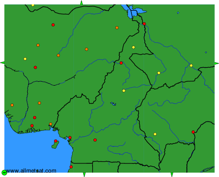
To change the map : click on the green buttons with a black cross to zoom in, on the green button with a dash to zoom out, or on the green arrows for adjacent maps.