METAR-TAF
Airports :
Oskemen Airport
Oskemen, Kazakhstan
latitude: 50-02-10N, longitude: 082-29-39E, elevation: 286 m
Current weather observation
The report was made 31 minutes ago, at 13:00 UTC
Wind 4 kt from the North
Temperature 20°C
Humidity 83%
Pressure 1010 hPa
Visibility 10 km or more
Scattered clouds at a height of 3300 ft, Cumulonimbus.
Broken clouds at a height of 9000 ft
Broken clouds at a height of 9000 ft
METAR: UASK 281300Z 36002MPS 9999 SCT033CB BKN090 20/17 Q1010 NOSIG RMK QFE732/0977
Time: 19:31 (13:31 UTC)
Forecast
The report was made 5 hours and 31 minutes ago, at 08:00 UTC
Forecast valid from 28 at 09 UTC to 28 at 18 UTC
Wind 12 kt from the North with gusts up to 21 kt
Visibility 10 km or more
Broken clouds at a height of 2000 ft, Cumulonimbus.
Broken clouds at a height of 7000 ft
Broken clouds at a height of 7000 ft
Temporary
from 28 at 09 UTC to 28 at 15 UTC
from 28 at 09 UTC to 28 at 15 UTC
Wind 31 kt from variable directions
Visibility: 2000 m
Scattered clouds at a height of 400 ft
Broken clouds at a height of 1500 ft, Cumulonimbus.
Broken clouds at a height of 1500 ft, Cumulonimbus.
thunderstorm, rain, hail, squalls
TAF: UASK 280800Z 2809/2818 01006G11MPS 9999 BKN020CB BKN070 TEMPO 2809/2815 VRB16MPS 2000 TSRAGR SQ SCT004 BKN015CB
Weather observations and forecasts of more than 4000 airports (METAR and TAF reports).
The available stations are represented by yellow and red dots on the map.
Hover mouse over dot to see the name of the station.
Then click to see weather observations and forecasts.
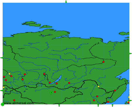
To change the map : click on the green buttons with a black cross to zoom in, on the green button with a dash to zoom out, or on the green arrows for adjacent maps.