METAR-TAF
Airports :
Khabarovsk Novy Airport
Khabarovsk, Russia
latitude: 48-31N, longitude: 135-10E, elevation: 72 m
Current weather observation
The report was made 36 minutes ago, at 06:30 UTC
Wind 10 kt from the Northeast, varying between North/Northeast and East
Temperature 29°C
Humidity 52%
Pressure 1007 hPa
Visibility 10 km or more
Few clouds at a height of 4300 ft
METAR: UHHH 230630Z 05005MPS 020V080 9999 FEW043 29/18 Q1007 R88/090060 NOSIG RMK QFE749/0999
Time: 17:06 (07:06 UTC)
Forecast
The report was made 2 hours and 28 minutes ago, at 04:38 UTC
Forecast valid from 23 at 06 UTC to 24 at 12 UTC
Wind 6 kt from the Northeast
Visibility 10 km or more
Scattered clouds at a height of 2000 ft, Cumulonimbus.
TAF: UHHH 230438Z 2306/2412 05003MPS 9999 SCT020CB TX30/2405Z TN19/2318Z
Weather observations and forecasts of more than 4000 airports (METAR and TAF reports).
The available stations are represented by yellow and red dots on the map.
Hover mouse over dot to see the name of the station.
Then click to see weather observations and forecasts.
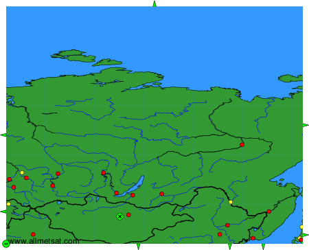
To change the map : click on the green buttons with a black cross to zoom in, on the green button with a dash to zoom out, or on the green arrows for adjacent maps.