METAR-TAF
Airports :
Abakan International Airport
Abakan, Russia
latitude: 53-45N, longitude: 091-24E, elevation: 804 ft
Current weather observation
The report was made 27 minutes ago, at 12:00 UTC
Wind 7 mph from the Southwest
Temperature 75°F
Humidity 61%
Pressure 29.50 in. Hg
Visibility 6.2 miles or more
no clouds below 1500 m and no cumulonimbus
METAR: UNAA 221200Z 23003MPS CAVOK 24/16 Q0999 R20/290150 NOSIG RMK QFE727
Time: 19:27 (12:27 UTC)
Forecast
The report was made 1 hour and 46 minutes ago, at 10:41 UTC
Forecast valid from 22 at 12 UTC to 23 at 12 UTC
Wind 7 mph from the South/Southwest with gusts up to 18 mph
Visibility: 19685 ft
Broken clouds at a height of 2000 ft
Temporary
from 22 at 12 UTC to 22 at 18 UTC
from 22 at 12 UTC to 22 at 18 UTC
Wind 18 mph from the West/Southwest with gusts up to 56 mph
Broken clouds at a height of 1600 ft, Cumulonimbus.
thunderstorm, light rain, hail
Temporary
from 23 at 00 UTC to 23 at 12 UTC
from 23 at 00 UTC to 23 at 12 UTC
Wind 18 mph from the West with gusts up to 40 mph
Broken clouds at a height of 1600 ft, Cumulonimbus.
thunderstorm, light rain
TAF: UNAA 221041Z 2212/2312 21003G08MPS 6000 BKN020 TEMPO 2212/2218 25008G25MPS -TSRAGR BKN016CB TEMPO 2300/2312 26008G18MPS -TSRA BKN016CB
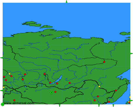
Weather observations and forecasts of more than 4000 airports (METAR and TAF reports).
The available stations are represented by yellow and red dots on the map.
Hover mouse over dot to see the name of the station.
Then click to see weather observations and forecasts.
To change the map : click on the green buttons with a black cross to zoom in, on the green button with a dash to zoom out, or on the green arrows for adjacent maps.