METAR-TAF
Airports :
Bangui M'Poko International Airport
Bangui, Central African Republic
latitude: 04-24N, longitude: 018-31E, elevation: 365 m
Current weather observation
The report was made 56 minutes ago, at 19:00 UTC
Calm wind
Temperature 26°C
Humidity 89%
Pressure 1013 hPa
Visibility: 8000 m
METAR: FEFF 111900Z 00000KT 8000 NSC 26/24 Q1013 TEMPO 4000 BR
Time: 20:56 (19:56 UTC)
Forecast
The report was made 2 hours and 56 minutes ago, at 17:00 UTC
Forecast valid from 11 at 18 UTC to 12 at 24 UTC
Wind 4 kt from the West
Visibility 10 km or more
Few clouds at a height of 1000 ft
Becoming
from 12 at 03 UTC to 12 at 05 UTC
from 12 at 03 UTC to 12 at 05 UTC
Visibility: 4000 m
Scattered clouds at a height of 400 ft
mist
From 12 at 0800 UTC
Wind 6 kt from the South/Southwest
Visibility 10 km or more
Scattered clouds at a height of 2000 ft
Becoming
from 12 at 10 UTC to 12 at 12 UTC
from 12 at 10 UTC to 12 at 12 UTC
Broken clouds at a height of 2600 ft
Few clouds at a height of 3300 ft, Cumulonimbus.
Few clouds at a height of 3300 ft, Cumulonimbus.
TAF: FEFF 111700Z 1118/1224 26004KT 9999 FEW010 BECMG 1203/1205 4000 BR SCT004 FM120800 20006KT 9999 SCT020 BECMG 1210/1212 BKN026 FEW033CB
Weather observations and forecasts of more than 4000 airports (METAR and TAF reports).
The available stations are represented by yellow and red dots on the map.
Hover mouse over dot to see the name of the station.
Then click to see weather observations and forecasts.
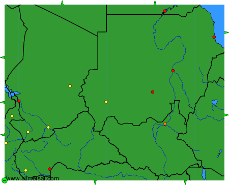
To change the map : click on the green buttons with a black cross to zoom in, on the green button with a dash to zoom out, or on the green arrows for adjacent maps.