Main page
METAR-TAF:

METAR-TAF

Airports :

United States Air Force Academy

Colorado Springs, Colorado, United States

latitude: 38-58N, longitude: 104-49W, elevation: 6570 ft

Current weather observation

The report was made 17 minutes ago, at 12:55 UTC
Wind 7 mph from the South/Southeast
Temperature 54°F
Humidity 82%
Pressure 30.34 in. Hg
Visibility: 10 miles
Scattered clouds at a height of 800 ft
Broken clouds at a height of 1100 ft
Overcast at a height of 2500 ft

METAR: KAFF 021255Z 16006KT 10SM SCT008 BKN011 OVC025 12/09 A3034 RMK AO2A SLP203 T01190087 $

Time: 07:12 (13:12 UTC)

Forecast

The report was made 2 hours and 3 minutes ago, at 11:09 UTC
Forecast valid from 02 at 11 UTC to 03 at 17 UTC
Wind 10 mph from the East, varying between East/Northeast and South/Southeast
Visibility 6.2 miles or more
Broken clouds at a height of 1800 ft
Overcast at a height of 3000 ft
Becoming
from 02 at 11 UTC to 02 at 12 UTC
Wind 10 mph from the South/Southeast
Visibility 6.2 miles or more
Broken clouds at a height of 1500 ft
Overcast at a height of 2000 ft
Becoming
from 02 at 15 UTC to 02 at 16 UTC
Wind 10 mph from the South/Southeast
Visibility 6.2 miles or more
Broken clouds at a height of 2000 ft
Becoming
from 02 at 16 UTC to 02 at 17 UTC
Wind 12 mph from the South/Southeast with gusts up to 17 mph
Visibility 6.2 miles or more
Scattered clouds at a height of 2000 ft
Scattered clouds at a height of 12000 ft
Becoming
from 02 at 19 UTC to 02 at 20 UTC
Wind 14 mph from the South/Southeast with gusts up to 25 mph
Visibility 6.2 miles or more
Scattered clouds at a height of 6000 ft
Broken clouds at a height of 12000 ft, Cumulonimbus.
thunderstorm in vicinity
Temporary
from 02 at 21 UTC to 03 at 01 UTC
Wind 29 mph from variable directions with gusts up to 40 mph
Broken clouds at a height of 6000 ft, Cumulonimbus.
Broken clouds at a height of 11000 ft
thunderstorm, light rain, hail
Becoming
from 03 at 02 UTC to 03 at 03 UTC
Wind 10 mph from the South/Southeast
Visibility 6.2 miles or more
Scattered clouds at a height of 5000 ft
Becoming
from 03 at 09 UTC to 03 at 10 UTC
Wind 10 mph from the South/Southeast
Visibility 6.2 miles or more
Overcast at a height of 1000 ft
Becoming
from 03 at 14 UTC to 03 at 15 UTC
Wind 10 mph from the South/Southeast
Visibility 6.2 miles or more
Few clouds at a height of 1500 ft
Scattered clouds at a height of 20000 ft

TAF: KAFF 021109Z 0211/0317 10009KT 9999 BKN018 OVC030 QNH3029INS WND 060V150 BECMG 0211/0212 16009KT 9999 BKN015 OVC020 QNH3029INS BECMG 0215/0216 16009KT 9999 BKN020 QNH3029INS BECMG 0216/0217 16010G15KT 9999 SCT020 SCT120 QNH3026INS BECMG 0219/0220 16012G22KT 9999 VCTS SCT060 BKN120CB QNH3024INS TEMPO 0221/0301 VRB25G35KT -TSRAGR BKN060CB BKN110 BECMG 0302/0303 16009KT NSW 9999 SCT050 QNH3027INS BECMG 0309/0310 16009KT 9999 OVC010 QNH3024INS BECMG 0314/0315 16009KT 9999 FEW015 SCT200 QNH3023INS TX27/0221Z TN12/0212Z

Weather observations and forecasts of more than 4000 airports (METAR and TAF reports).

The available stations are represented by yellow and red dots on the map.

Hover mouse over dot to see the name of the station.

Then click to see weather observations and forecasts.

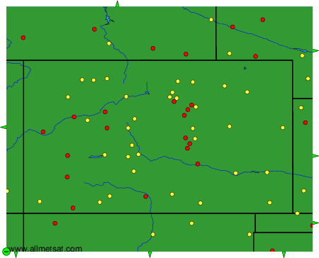
To change the map : click on the green buttons with a black cross to zoom in, on the green button with a dash to zoom out, or on the green arrows for adjacent maps.


METAR-TAF: