METAR-TAF
Airports :
Aspen
Akron
Alamosa
Alliance
Aspen
Aurora
Blanding
Boulder
Broomfield
Burlington
Centennial
Cheyenne
Clayton
Colorado Springs
Colorado Springs
Colorado Springs
Copper Mountain
Cortez
Cottonwood Pass
Craig
Dalhart
Denver
Denver
Durango
Eagle
Elbert
Elkhart
Erie
Farmington
Fort Carson
Fort Collins / Loveland
Fort Morgan
Goodland
Grand Junction
Greeley
Gunnison
Guymon
Hayden
Imperial
Kimball
Kremmling
La Junta
Lamar
Laramie
La Veta
Leadville
Limon
Longmont
Meeker
Montrose
Ogallala
Pagosa Springs
Pagosa Springs
Pueblo
Raton
Rawlins
Rifle
Rock Springs
Saguache
Salida
Salida
Saratoga
Scottsbluff
Sidney
Springfield
Stanton County
Steamboat Springs
St. Francis
Sunlight Mountain
Taos
Telluride
Torrington
Trinidad
Colorado
Arizona
Kansas
Nebraska
New Mexico
North America
Oklahoma
Texas, West
Utah
Wyoming
Aspen–Pitkin County Airport Aspen, Colorado, United States
latitude: 39-13-44N, longitude: 106-52-10W, elevation: 7813 ft
Current weather observation The report was made 48 minutes ago, at 22:53 UTC
Wind 12 mph from the Northwest
Temperature 66 °F
Humidity 26 %
Pressure 30.27 in. Hg
Visibility: 10 miles
Clear sky
METAR: KASE 212253Z 32010KT 10SM CLR 19/M01 A3027 RMK AO2 SLP155 T01941011
Time: 17:41 (23:41 UTC) Forecast The report was made 13 minutes ago, at 23:28 UTC
Forecast valid from 22 at 00 UTC to 22 at 24 UTC
Wind 7 mph from variable directions
Visibility: 6 miles
Scattered clouds at a height of 9000 ft Broken clouds at a height of 20000 ft
From 22 at 0200 UTC
Wind 8 mph from the South/Southwest
Visibility: 6 miles
Few clouds at a height of 10000 ft
From 22 at 1700 UTC
Wind 9 mph from the North/Northwest
Visibility: 6 miles
Few clouds at a height of 10000 ft
Probability 30%
Wind 17 mph from variable directions with gusts up to 29 mph
Visibility: 4 miles
Broken clouds at a height of 8000 ft, Cumulonimbus.
thunderstorm, light rain
TAF: KASE 212328Z 2200/2224 VRB06KT P6SM SCT090 BKN200 FM220200 20007KT P6SM FEW100 FM221700 33008KT P6SM FEW100 PROB30 2218/2224 VRB15G25KT 4SM -TSRA BKN080CB
Weather observations and forecasts of more than 4000 airports (METAR and TAF reports).
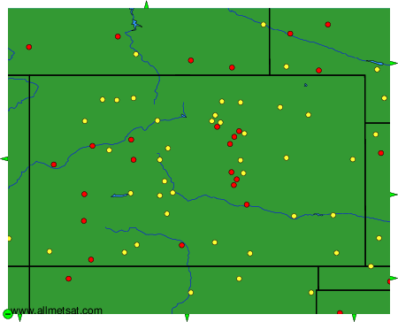
The available stations are represented by yellow and red dots on the map.
Hover mouse over dot to see the name of the station.
Then click to see weather observations and forecasts.
To change the map : click on the green buttons with a black cross to zoom in, on the green button with a dash to zoom out, or on the green arrows for adjacent maps.