METAR-TAF
Airports :
Miami
Bayamo
Camagüey
Cayman Brac
Cayo Coco
Cayo Largo del Sur
Cienfuegos
George Town
Guantánamo
Guantánamo
Havana
Havana
Holguín
Homestead
Key West
Kingston
Las Tunas
Manzanillo
Marathon
Moa
Montego Bay
NAS Key West
Nassau
Santa Clara
Santiago de Cuba
Varadero
Cuba, Jamaica
Belize
Colombia
Costa Rica
Dominican Republic
El Salvador
Florida
Guatemala
Haiti
Honduras
Mexico, East
Nicaragua
North America
Panama
The Bahamas
Miami International Airport Miami, Florida, United States
latitude: 25-47-26N, longitude: 080-18-59W, elevation: 3 m
Current weather observation The report was made 24 minutes ago, at 02:53 UTC
Wind 8 kt from the East
Temperature 28 °C
Humidity 74 %
Pressure 1020 hPa
Visibility: 16.1 km
Few clouds at a height of 2400 ft Broken clouds at a height of 25000 ft
METAR: KMIA 090253Z 09008KT 10SM FEW024 BKN250 28/23 A3011 RMK AO2 SLP194 T02780228 51018 PNO $
Time: 23:17 (03:17 UTC) Forecast The report was made 17 minutes ago, at 03:00 UTC
Forecast valid from 09 at 03 UTC to 10 at 06 UTC
Wind 7 kt from the East
Visibility: 10 km
Few clouds at a height of 4000 ft
From 09 at 0600 UTC
Wind 4 kt from variable directions
Visibility: 10 km
Scattered clouds at a height of 3000 ft Scattered clouds at a height of 5000 ft
From 09 at 1600 UTC
Wind 9 kt from the East
Visibility: 10 km
Scattered clouds at a height of 3000 ft, Cumulonimbus. Broken clouds at a height of 5000 ft
thunderstorm in vicinity
From 10 at 0200 UTC
Wind 7 kt from the East
Visibility: 10 km
Few clouds at a height of 4000 ft
TAF: KMIA 090300Z 0903/1006 10007KT P6SM FEW040 FM090600 VRB04KT P6SM SCT030 SCT050 FM091600 10009KT P6SM VCTS SCT030CB BKN050 FM100200 08007KT P6SM FEW040
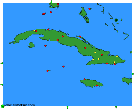
Weather observations and forecasts of more than 4000 airports (METAR and TAF reports).
The available stations are represented by yellow and red dots on the map.
Hover mouse over dot to see the name of the station.
Then click to see weather observations and forecasts.
To change the map : click on the green buttons with a black cross to zoom in, on the green button with a dash to zoom out, or on the green arrows for adjacent maps.