METAR-TAF
Airports :
Sangster International Airport
Montego Bay, Jamaica
latitude: 18-30N, longitude: 077-55W, elevation: 1 m
Current weather observation
The report was made 57 minutes ago, at 05:00 UTC
Wind 4 kt from the South/Southwest
Temperature 28°C
Humidity 84%
Pressure 1013 hPa
Visibility 10 km or more
Few clouds at a height of 2200 ft, Cumulonimbus.
thunderstorm in vicinity
METAR: MKJS 020500Z 20004KT 9999 VCTS FEW022CB 28/25 Q1013
Time: 00:57 (05:57 UTC)
Forecast
The report was made 42 minutes ago, at 05:15 UTC
Forecast valid from 02 at 06 UTC to 03 at 06 UTC
Wind 5 kt from the East/Southeast
Visibility 10 km or more
Few clouds at a height of 2200 ft
Becoming
from 02 at 14 UTC to 02 at 16 UTC
from 02 at 14 UTC to 02 at 16 UTC
Wind 15 kt from the East
Probability 40% :
Temporary
from 02 at 18 UTC to 02 at 23 UTC
from 02 at 18 UTC to 02 at 23 UTC
Visibility: 5000 m
Scattered clouds at a height of 1600 ft
Broken clouds at a height of 1800 ft, Cumulonimbus.
Broken clouds at a height of 1800 ft, Cumulonimbus.
thunderstorm, rain
TAF: MKJS 020515Z 0206/0306 11005KT 9999 FEW022 BECMG 0214/0216 08015KT PROB40 TEMPO 0218/0223 5000 TSRA SCT016 BKN018CB
Weather observations and forecasts of more than 4000 airports (METAR and TAF reports).
The available stations are represented by yellow and red dots on the map.
Hover mouse over dot to see the name of the station.
Then click to see weather observations and forecasts.
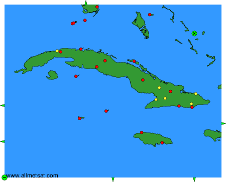
To change the map : click on the green buttons with a black cross to zoom in, on the green button with a dash to zoom out, or on the green arrows for adjacent maps.