METAR-TAF
Airports :
Ignacio Agramonte International Airport
Camagüey, Cuba
latitude: 21-25N, longitude: 077-51W, elevation: 122 m
Current weather observation
The report was made 56 minutes ago, at 04:50 UTC
Wind 4 kt from the West
Temperature 24°C
Humidity 83%
Pressure 1013 hPa
Visibility: 9000 m
METAR: MUCM 070450Z 26004KT 9000 NSC 24/21 Q1013
Time: 01:46 (05:46 UTC)
Forecast
The report was made 46 minutes ago, at 05:00 UTC
Forecast valid from 07 at 06 UTC to 08 at 06 UTC
Wind 4 kt from the West
Visibility: 9000 m
Scattered clouds at a height of 2000 ft
Temporary
from 07 at 09 UTC to 07 at 13 UTC
from 07 at 09 UTC to 07 at 13 UTC
Visibility: 2000 m
mist
Temporary
from 07 at 10 UTC to 07 at 13 UTC
from 07 at 10 UTC to 07 at 13 UTC
Visibility: 0800 m
fog
Becoming
from 07 at 15 UTC to 07 at 16 UTC
from 07 at 15 UTC to 07 at 16 UTC
Wind 10 kt from the South/Southwest
Becoming
from 08 at 03 UTC to 08 at 05 UTC
from 08 at 03 UTC to 08 at 05 UTC
Wind 3 kt from variable directions
TAF: MUCM 070500Z 0706/0806 26004KT 9000 SCT020 TEMPO 0709/0713 2000 BR TEMPO 0710/0713 0800 FG BECMG 0715/0716 20010KT BECMG 0803/0805 VRB03KT
Weather observations and forecasts of more than 4000 airports (METAR and TAF reports).
The available stations are represented by yellow and red dots on the map.
Hover mouse over dot to see the name of the station.
Then click to see weather observations and forecasts.
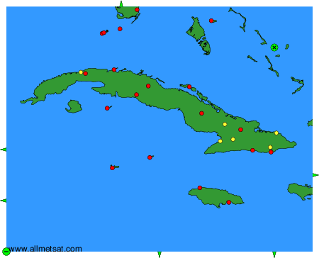
To change the map : click on the green buttons with a black cross to zoom in, on the green button with a dash to zoom out, or on the green arrows for adjacent maps.