METAR-TAF
Airports :
Antonio Maceo Airport
Santiago de Cuba, Cuba
latitude: 19-58N, longitude: 075-51W, elevation: 69 m
Current weather observation
The report was made 40 minutes ago, at 20:50 UTC
Temperature 26°C
Humidity 70%
Pressure 1014 hPa
METAR: MUCU 022050Z AUTO /////KT 26/20 Q1014
Time: 17:30 (21:30 UTC)
Forecast
The report was made 4 hours and 30 minutes ago, at 17:00 UTC
Forecast valid from 02 at 18 UTC to 03 at 18 UTC
Wind 12 kt from the East/Southeast
Visibility: 9000 m
Scattered clouds at a height of 2000 ft
Temporary
from 02 at 19 UTC to 02 at 24 UTC
from 02 at 19 UTC to 02 at 24 UTC
Visibility: 5000 m
Scattered clouds at a height of 2000 ft, Cumulonimbus.
Broken clouds at a height of 3000 ft
Broken clouds at a height of 3000 ft
thunderstorm, rain showers
Becoming
from 03 at 00 UTC to 03 at 03 UTC
from 03 at 00 UTC to 03 at 03 UTC
Wind 5 kt from the North
Becoming
from 03 at 17 UTC to 03 at 18 UTC
from 03 at 17 UTC to 03 at 18 UTC
Wind 10 kt from the East/Southeast
TAF: MUCU 021700Z 0218/0318 12012KT 9000 SCT020 TEMPO 0219/0224 5000 TS SHRA SCT020CB BKN030 BECMG 0300/0303 36005KT BECMG 0317/0318 12010KT
Weather observations and forecasts of more than 4000 airports (METAR and TAF reports).
The available stations are represented by yellow and red dots on the map.
Hover mouse over dot to see the name of the station.
Then click to see weather observations and forecasts.
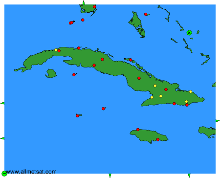
To change the map : click on the green buttons with a black cross to zoom in, on the green button with a dash to zoom out, or on the green arrows for adjacent maps.