METAR-TAF
Airports :
Larnaca International Airport
Larnaca, Cyprus
latitude: 34-53N, longitude: 033-38E, elevation: 2 m
Current weather observation
The report was made 16 minutes ago, at 21:00 UTC
Wind 10 kt from the Northwest
Temperature 13°C
Humidity 82%
Pressure 1018 hPa
Visibility 10 km or more
no clouds below 1500 m and no cumulonimbus
METAR: LCLK 062100Z 31010KT CAVOK 13/10 Q1018 NOSIG
Time: 23:16 (21:16 UTC)
Forecast
The report was made 3 hours and 46 minutes ago, at 17:30 UTC
Forecast valid from 06 at 18 UTC to 07 at 18 UTC
Wind 7 kt from the Northwest
Visibility 10 km or more
Few clouds at a height of 3000 ft
Becoming
from 07 at 06 UTC to 07 at 10 UTC
from 07 at 06 UTC to 07 at 10 UTC
Wind 15 kt from the Northeast
Becoming
from 07 at 14 UTC to 07 at 18 UTC
from 07 at 14 UTC to 07 at 18 UTC
Wind 9 kt from the North/Northwest
TAF: LCLK 061730Z 0618/0718 31007KT 9999 FEW030 BECMG 0706/0710 04015KT BECMG 0714/0718 34009KT
Weather observations and forecasts of more than 4000 airports (METAR and TAF reports).
The available stations are represented by yellow and red dots on the map.
Hover mouse over dot to see the name of the station.
Then click to see weather observations and forecasts.
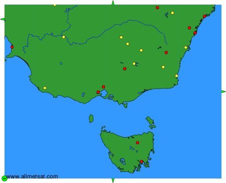
To change the map : click on the green buttons with a black cross to zoom in, on the green button with a dash to zoom out, or on the green arrows for adjacent maps.