METAR-TAF
Airports :
Grand Forks
Aberdeen
Baker
Bismarck
Buffalo
Chadron
Chamberlain
Crookston
Custer
Devils Lake
Dickinson
Faith
Fargo
Garrison
Grand Forks
Grand Forks
Gwinner
Hallock
Hazen
Hettinger
Huron
Jamestown
Madison
Minot
Minot
Mitchell
Mobridge
Moorhead
Ortonville
Philip
Pierre
Pine Ridge
Pipestone
Rapid City
Rapid City / Ellsworth
Rugby
Sidney
Sioux Falls
Sisseton
Spearfish
Valentine
Wahpeton
Watertown
Wheaton
Williston
Winner
Yankton
Dakota
Iowa
Manitoba
Minnesota
Montana, East
Nebraska
North America
Saskatchewan
Wyoming
Grand Forks International Airport Grand Forks, North Dakota, United States
latitude: 47-56-53N, longitude: 097-10-57W, elevation: 843 ft
Current weather observation The report was made 50 minutes ago, at 04:53 UTC
Wind 17 mph from the South
Temperature 16 °F
Humidity 79 %
Pressure 29.62 in. Hg
Visibility: 10 miles
Scattered clouds at a height of 9500 ft
METAR: KGFK 260453Z 19015KT 10SM SCT095 M09/M12 A2962 RMK AO2 SLP049 T10941122
Time: 23:43 (05:43 UTC) Forecast The report was made 23 minutes ago, at 05:20 UTC
Forecast valid from 26 at 06 UTC to 27 at 06 UTC
Wind 13 mph from the South
Visibility: 6 miles
Broken clouds at a height of 8000 ft
From 26 at 1200 UTC
Wind 9 mph from the Southwest
Visibility: 6 miles
Broken clouds at a height of 20000 ft
From 26 at 1600 UTC
Wind 10 mph from the West
Visibility: 6 miles
Scattered clouds at a height of 25000 ft
From 26 at 2300 UTC
Wind 14 mph from the West/Southwest
Visibility: 6 miles
Scattered clouds at a height of 20000 ft
TAF: KGFK 260520Z 2606/2706 19011KT P6SM BKN080 WS020/27030KT FM261200 22008KT P6SM BKN200 FM261600 27009KT P6SM SCT250 FM262300 24012KT P6SM SCT200
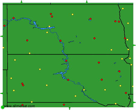
Weather observations and forecasts of more than 4000 airports (METAR and TAF reports).
The available stations are represented by yellow and red dots on the map.
Hover mouse over dot to see the name of the station.
Then click to see weather observations and forecasts.
To change the map : click on the green buttons with a black cross to zoom in, on the green button with a dash to zoom out, or on the green arrows for adjacent maps.
