METAR-TAF
Airports :
Rapid City / Ellsworth
Aberdeen
Baker
Bismarck
Buffalo
Chadron
Chamberlain
Crookston
Custer
Devils Lake
Dickinson
Faith
Fargo
Garrison
Grand Forks
Grand Forks
Gwinner
Hallock
Hazen
Hettinger
Huron
Jamestown
Madison
Minot
Minot
Mitchell
Mobridge
Moorhead
Ortonville
Philip
Pierre
Pine Ridge
Pipestone
Rapid City
Rapid City / Ellsworth
Rugby
Sidney
Sioux Falls
Sisseton
Spearfish
Valentine
Wahpeton
Watertown
Wheaton
Williston
Winner
Yankton
Dakota
Iowa
Manitoba
Minnesota
Montana, East
Nebraska
North America
Saskatchewan
Wyoming
Ellsworth Air Force Base Rapid City / Ellsworth, South Dakota, United States
latitude: 44-09N, longitude: 103-06W, elevation: 3277 ft
Current weather observation The report was made 19 minutes ago, at 18:37 UTC
Wind 13 mph from the Northeast with gusts up to 17 mph
Temperature 57 °F
Humidity 31 %
Pressure 30.07 in. Hg
Visibility: 10 miles
Few clouds at a height of 19000 ft Few clouds at a height of 22000 ft
METAR: KRCA 011837Z AUTO 04011G15KT 10SM FEW190 FEW220 14/M03 A3007 RMK AO2 WSHFT 35 SLP191
Time: 12:56 (18:56 UTC) Forecast The report was made 7 hours and 56 minutes ago, at 11:00 UTC
Forecast valid from 01 at 11 UTC to 02 at 17 UTC
Wind 7 mph from variable directions
Visibility 6.2 miles or more
Few clouds at a height of 6000 ft
Becoming
Wind 12 mph from the North/Northeast with gusts up to 23 mph
Visibility 6.2 miles or more
Few clouds at a height of 5000 ft
Becoming
Wind 3 mph from variable directions
Visibility 6.2 miles or more
Few clouds at a height of 8000 ft
TAF: KRCA 011100Z 0111/0217 VRB06KT 9999 FEW060 QNH3003INS BECMG 0119/0120 03010G20KT 9999 FEW050 QNH3005INS BECMG 0202/0203 VRB03KT 9999 FEW080 QNH3009INS TX16/0120Z TNM01/0111Z
Weather observations and forecasts of more than 4000 airports (METAR and TAF reports).
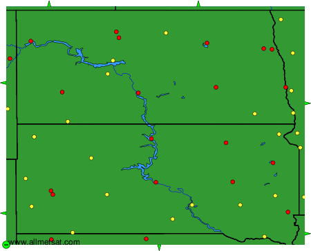
The available stations are represented by yellow and red dots on the map.
Hover mouse over dot to see the name of the station.
Then click to see weather observations and forecasts.
To change the map : click on the green buttons with a black cross to zoom in, on the green button with a dash to zoom out, or on the green arrows for adjacent maps.
