METAR-TAF
Airports :
Toussaint Louverture International Airport
Port-au-Prince, Haiti
latitude: 18-34N, longitude: 072-18W, elevation: 31 m
Current weather observation
Scattered clouds at a height of 20000 ft
METAR: MTPP 311400Z 12012KT 7000 FEW026 SCT200 32/24 Q1015 A3000
Time: 10:44 (14:44 UTC)
Forecast
Scattered clouds at a height of 20000 ft
from 31 at 13 UTC to 31 at 20 UTC
from 31 at 22 UTC to 01 at 05 UTC
Broken clouds at a height of 4000 ft
from 01 at 06 UTC to 01 at 09 UTC
Scattered clouds at a height of 22000 ft
TAF: MTPP 311100Z 3112/0112 13006KT 8000 FEW020 SCT200 PROB30 TEMPO 3113/3120 09015G25KT FEW026TCU FM312100 10012KT 8000 SCT024CB PROB40 TEMPO 3122/0105 26014KT 4900 SCT014CB BKN040 BECMG 0106/0109 11010KT 7000 FEW020CB SCT220
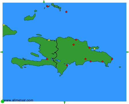
Weather observations and forecasts of more than 4000 airports (METAR and TAF reports).
The available stations are represented by yellow and red dots on the map.
Hover mouse over dot to see the name of the station.
Then click to see weather observations and forecasts.
To change the map : click on the green buttons with a black cross to zoom in, on the green button with a dash to zoom out, or on the green arrows for adjacent maps.