METAR-TAF
Airports :
Great Falls
Baker
Billings
Bozeman
Buffalo
Cody
Coronach
Driggs
Gillette
Glasgow
Glendive
Great Falls
Great Falls
Greybull
Havre
Jackson
Jordan
Lewistown
Livingston
Miles City
Onefour
Riverton
Rockglen
Roundup
Sheridan
Sidney
Val Marie
West Yellowstone
Wolf Point
Worland
Yellowstone Lake
Montana, East
Alberta
Dakota
Idaho
Montana, West
Nebraska
North America
Saskatchewan
Wyoming
Great Falls International Airport Great Falls, Montana, United States
latitude: 47-28-24N, longitude: 111-22-56W, elevation: 3674 ft
Current weather observation The report was made 30 minutes ago, at 17:53 UTC
Wind 8 mph from the West with gusts up to 22 mph, varying between West/Southwest and West/Northwest
Temperature 59 °F
Humidity 23 %
Pressure 29.93 in. Hg
Visibility: 10 miles
Clear sky
METAR: KGTF 061753Z 26007G19KT 240V300 10SM CLR 15/M06 A2993 RMK AO2 SLP147 T01501056 10150 21039 58021 $
Time: 12:23 (18:23 UTC) Forecast The report was made 1 hour and 3 minutes ago, at 17:20 UTC
Forecast valid from 06 at 18 UTC to 07 at 18 UTC
Wind 13 mph from the Southwest
Visibility: 6 miles
Clear sky
From 06 at 2200 UTC
Wind 17 mph from the West/Northwest with gusts up to 29 mph
Visibility: 6 miles
Few clouds at a height of 20000 ft
From 07 at 0300 UTC
Wind 9 mph from the Southwest
Visibility: 6 miles
Broken clouds at a height of 10000 ft
Probability 30%
Wind 17 mph from variable directions with gusts up to 29 mph
Visibility: 5 miles
Overcast at a height of 3500 ft
light rain showers
From 07 at 1400 UTC
Wind 13 mph from the Northwest
Visibility: 6 miles
Scattered clouds at a height of 5000 ft
TAF: KGTF 061720Z 0618/0718 23011KT P6SM SKC FM062200 29015G25KT P6SM FEW200 FM070300 22008KT P6SM BKN100 PROB30 0705/0711 VRB15G25KT 5SM -SHRA OVC035 FM071400 31011KT P6SM SCT050
Weather observations and forecasts of more than 4000 airports (METAR and TAF reports).
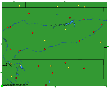
The available stations are represented by yellow and red dots on the map.
Hover mouse over dot to see the name of the station.
Then click to see weather observations and forecasts.
To change the map : click on the green buttons with a black cross to zoom in, on the green button with a dash to zoom out, or on the green arrows for adjacent maps.
