METAR-TAF
Airports :
Kushiro Airport
Kushiro, Japan
latitude: 43-02N, longitude: 144-12E, elevation: 95 m
Current weather observation
Scattered clouds at a height of 3000 ft
Broken clouds
METAR: RJCK 011000Z 22003KT 180V240 9999 FEW010 SCT030 BKN/// 15/14 Q1008
Time: 19:44 (10:44 UTC)
Forecast
Scattered clouds at a height of 800 ft
from 01 at 10 UTC to 01 at 12 UTC
from 01 at 16 UTC to 01 at 18 UTC
Broken clouds at a height of 800 ft
from 01 at 18 UTC to 02 at 00 UTC
Broken clouds at a height of 300 ft
from 01 at 21 UTC to 02 at 00 UTC
from 02 at 06 UTC to 02 at 12 UTC
Broken clouds at a height of 800 ft
TAF: RJCK 010505Z 0106/0212 18010KT 9999 FEW005 SCT008 BECMG 0110/0112 35004KT TEMPO 0116/0118 FEW003 BKN008 TEMPO 0118/0200 1500 BR FEW001 BKN003 BECMG 0121/0200 17010KT TEMPO 0206/0212 FEW003 BKN008
Weather observations and forecasts of more than 4000 airports (METAR and TAF reports).
The available stations are represented by yellow and red dots on the map.
Hover mouse over dot to see the name of the station.
Then click to see weather observations and forecasts.
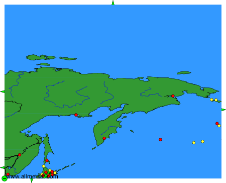
To change the map : click on the green buttons with a black cross to zoom in, on the green button with a dash to zoom out, or on the green arrows for adjacent maps.