METAR-TAF
Airports :
Petropavlovsk-Kamchatsky Airport
Petropavlovsk-Kamchatsky, Russia
latitude: 53-05N, longitude: 158-35E, elevation: 24 m
Current weather observation
METAR: UHPP 302200Z 19002MPS 130V240 2300 BR OVC002 12/12 Q1009 R16R/CLRD62 NOSIG RMK MT OBSC QFE754/1005
Time: 10:32 (22:32 UTC)
Forecast
Overcast at a height of 1500 ft
from 30 at 21 UTC to 30 at 22 UTC
from 30 at 22 UTC to 31 at 01 UTC
from 31 at 09 UTC to 31 at 12 UTC
Overcast at a height of 2000 ft, Cumulonimbus.
from 31 at 12 UTC to 31 at 21 UTC
from 31 at 21 UTC to 31 at 24 UTC
TAF: UHPP 301935Z 3021/0103 18003G10MPS 1500 BR BKN003 OVC015 TEMPO 3021/3022 0700 FG VV002 BECMG 3022/3101 9999 NSW SCT030CB BECMG 3109/3112 BKN014 OVC020CB TEMPO 3112/3121 1000 -SHRA BR VV003 TEMPO 3121/3124 2000 -SHRA BR VV005
Weather observations and forecasts of more than 4000 airports (METAR and TAF reports).
The available stations are represented by yellow and red dots on the map.
Hover mouse over dot to see the name of the station.
Then click to see weather observations and forecasts.
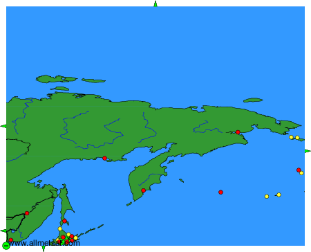
To change the map : click on the green buttons with a black cross to zoom in, on the green button with a dash to zoom out, or on the green arrows for adjacent maps.