METAR-TAF
Airports :
Tulsa
Abilene
Abilene
Ada
Altus
Altus
Angleton / Lake Jackson
Ardmore-Downtown Executive
Ardmore-Municipal
Arlington
Atoka
Austin–Bergstrom
Austin-Camp Mabry
Austin-Executive
Bay City
Beaumont
Beaumont / Port Arthur
Bossier City
Brenham
Bridgeport
Brownwood
Bryan
Burnet
Childress
Cleburne
Coleman
College Station
Comanche
Corsicana
Dallas / Addison
Dallas-Executive
Dallas / Fort Worth
Dallas Love Field
Decatur
Del Rio
Del Rio
Denton
De Queen
DeRidder
Duncan
Durant
Fort Hood / Killeen
Fort Hood / Killeen
Fort Sill
Fort Worth-Alliance
Fort Worth-Meacham
Fort Worth-Spinks
Frederick
Fredericksburg
Gainesville
Galveston
Gatesville
Georgetown
Giddings
Gilmer
Graham
Granbury
Grand Prairie
Greenville
Hamilton
Hearne
Hillsboro
Hobart
Hondo
Houston
Houston
Houston
Houston
Houston
Houston / Conroe
Houston / Pearland
Houston / Sugar Land
Houston / Tomball
Hugo
Huntsville
Jacksonville
Jasper
Junction
Kerrville
Killeen
La Grange
Lancaster
Lawton
Llano
Longview
Lufkin
Marshall
McAlester
McKinney
Mesquite
Midlothian / Waxahachie
Mineola / Quitman
Mineral Wells
Mount Ida
Mount Pleasant
Nacogdoches
NAS Fort Worth JRB
New Braunfels
Orange
Palacios
Palestine
Paris
Pauls Valley
Piedras Negras
Poteau
Rocksprings
San Angelo
San Antonio
San Antonio
San Antonio
San Marcos
Sherman / Denison
Shreveport-Downtown
Shreveport-Regional
Snyder
Sonora
Stephenville
Sulphur Springs
Sweetwater
Temple
Terrell
Texarkana
Tyler
Universal City
Uvalde
Vernon
Victoria
Waco
Waco
Waco
Wharton
Wichita Falls
Texas, East
Arkansas
Louisiana
Mexico, Northeast
North America
Oklahoma
Texas, South
Texas, West
Tulsa International Airport Tulsa, Oklahoma, United States
latitude: 36-11-51N, longitude: 095-53-11W, elevation: 676 ft
Current weather observation The report was made 46 minutes ago, at 04:53 UTC
Wind 12 mph from the South/Southeast
Temperature 82 °F
Humidity 70 %
Pressure 29.97 in. Hg
Visibility: 10 miles
Scattered clouds at a height of 25000 ft
METAR: KTUL 010453Z 16010KT 10SM SCT250 28/22 A2997 RMK AO2 SLP137 T02780217
Time: 00:39 (05:39 UTC) Forecast The report was made 16 minutes ago, at 05:23 UTC
Forecast valid from 01 at 06 UTC to 02 at 06 UTC
Wind 13 mph from the South/Southeast
Visibility: 6 miles
Few clouds at a height of 25000 ft
From 01 at 1500 UTC
Wind 15 mph from the South with gusts up to 25 mph
Visibility: 6 miles
Few clouds at a height of 5000 ft
From 02 at 0100 UTC
Wind 12 mph from the South/Southeast
Visibility: 6 miles
Scattered clouds at a height of 25000 ft
TAF: KTUL 010523Z 0106/0206 16011KT P6SM FEW250 FM011500 18013G22KT P6SM FEW050 FM020100 16010KT P6SM SCT250
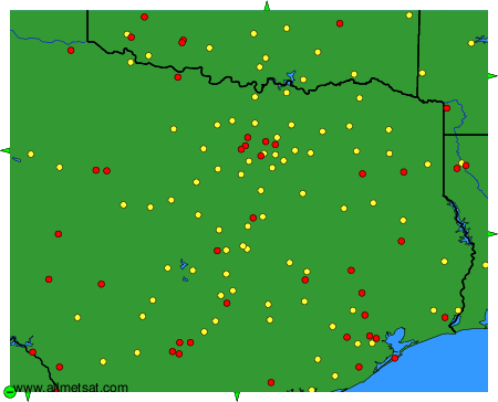
Weather observations and forecasts of more than 4000 airports (METAR and TAF reports).
The available stations are represented by yellow and red dots on the map.
Hover mouse over dot to see the name of the station.
Then click to see weather observations and forecasts.
To change the map : click on the green buttons with a black cross to zoom in, on the green button with a dash to zoom out, or on the green arrows for adjacent maps.