METAR-TAF
Airports :
St. Catherine International Airport
Saint Catherine, Egypt
latitude: 28-41-07N, longitude: 034-03-45E, elevation: 1331 m
METAR: missing
Time: 11:00 (09:00 UTC)
Forecast
The report was made 4 hours and 0 minutes ago, at 05:00 UTC
Forecast valid from 25 at 06 UTC to 26 at 12 UTC
Wind 18 kt from the West/Southwest with gusts up to 28 kt
Visibility: 6000 m
Scattered clouds at a height of 2500 ft
Temporary
from 25 at 06 UTC to 25 at 15 UTC
from 25 at 06 UTC to 25 at 15 UTC
Visibility: 3000 m
sand
Temporary
from 25 at 06 UTC to 25 at 12 UTC
from 25 at 06 UTC to 25 at 12 UTC
Visibility: 1000 m
Broken clouds at a height of 2500 ft
rain, sand
Temporary
from 25 at 06 UTC to 25 at 09 UTC
from 25 at 06 UTC to 25 at 09 UTC
Visibility: 2000 m
Few clouds at a height of 2000 ft, Cumulonimbus.
thunderstorm, light rain
TAF: HESC 250500Z 2506/2612 25018G28KT 6000 SCT025 TEMPO 2506/2515 3000 SA TEMPO 2506/2512 1000 RA SA BKN025 TEMPO 2506/2509 2000 -TSRA FEW020CB
Weather observations and forecasts of more than 4000 airports (METAR and TAF reports).
The available stations are represented by yellow and red dots on the map.
Hover mouse over dot to see the name of the station.
Then click to see weather observations and forecasts.
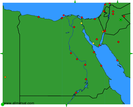
To change the map : click on the green buttons with a black cross to zoom in, on the green button with a dash to zoom out, or on the green arrows for adjacent maps.