METAR-TAF
Airports :
Tel Aviv / Ben Gurion
Abu Simbel
Alexandria-Borg El Arab
Alexandria-El Nouzha
Al Wajh
Amman
Amman-Queen Alia
Aqaba
Arish
Aswan
Asyut
Cairo
Eilat
El-Tor
Haifa
Hurghada
Ismaïlia
Kufra
Luxor
Marsa Alam
Marsa Matruh
Port Said
Qurayyat
Rosh Pinna
Saint Catherine
Sharm el-Sheikh
Sohag
Taba
Tabuk
Tel Aviv
Egypt
Africa
Central African Republic
Chad
Israel
Jordan
Lebanon
Libya
Palestine
Saudi Arabia
Sudan
Syria
Turkey
Ben Gurion Airport Tel Aviv / Ben Gurion, Israel
latitude: 32-00N, longitude: 034-54E, elevation: 40 m
Current weather observation The report was made 29 minutes ago, at 13:20 UTC
Wind 10 kt from the West
Temperature 30 °C
Humidity 59 %
Pressure 1007 hPa
Visibility 10 km or more
Few clouds at a height of 3000 ft
METAR: LLBG 051320Z 26010KT 9999 FEW030 30/21 Q1007 NOSIG
Time: 16:49 (13:49 UTC) Forecast The report was made 2 hours and 48 minutes ago, at 11:01 UTC
Forecast valid from 05 at 12 UTC to 06 at 12 UTC
Wind 12 kt from the West
Visibility 10 km or more
Few clouds at a height of 3500 ft
Becoming
Wind 4 kt from variable directions
Few clouds at a height of 2500 ft
Becoming
Scattered clouds at a height of 2500 ft
Probability 40% :
Temporary
Wind 6 kt from the South
Broken clouds at a height of 2000 ft
Becoming
Wind 12 kt from the West
Few clouds at a height of 3500 ft
TAF: LLBG 051101Z 0512/0612 27012KT 9999 FEW035 TX31/0512Z TN25/0603Z BECMG 0515/0517 VRB04KT FEW025 BECMG 0519/0521 SCT025 PROB40 TEMPO 0521/0606 17006KT BKN020 BECMG 0607/0609 26012KT FEW035
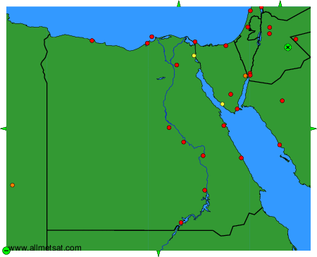
Weather observations and forecasts of more than 4000 airports (METAR and TAF reports).
The available stations are represented by yellow and red dots on the map.
Hover mouse over dot to see the name of the station.
Then click to see weather observations and forecasts.
To change the map : click on the green buttons with a black cross to zoom in, on the green button with a dash to zoom out, or on the green arrows for adjacent maps.