METAR-TAF
Airports :
Cotopaxi International Airport
Latacunga, Ecuador
latitude: 00-55S, longitude: 078-37W, elevation: 2785 m
Current weather observation
The report was made 14 minutes ago, at 16:00 UTC
Wind 13 kt from the South
Temperature 13°C
Humidity 72%
Pressure 1033 hPa
Visibility 10 km or more
Broken clouds at a height of 3000 ft
METAR: SELT 271600Z 18013KT 9999 BKN030 13/08 Q1033 RMK A3053
Time: 11:14 (16:14 UTC)
Forecast
The report was made 5 hours and 9 minutes ago, at 11:05 UTC
Forecast valid from 27 at 12 UTC to 28 at 12 UTC
Wind 6 kt from the South
Visibility 10 km or more
Broken clouds at a height of 3000 ft
Becoming
from 27 at 16 UTC to 27 at 18 UTC
from 27 at 16 UTC to 27 at 18 UTC
Wind 17 kt from the South
Becoming
from 28 at 00 UTC to 28 at 02 UTC
from 28 at 00 UTC to 28 at 02 UTC
Wind 6 kt from the South
Scattered clouds at a height of 3000 ft
TAF: SELT 271105Z 2712/2812 19006KT 9999 BKN030 BECMG 2716/2718 18017KT BECMG 2800/2802 17006KT SCT030 TX17/2719Z TN06/2811Z
Weather observations and forecasts of more than 4000 airports (METAR and TAF reports).
The available stations are represented by yellow and red dots on the map.
Hover mouse over dot to see the name of the station.
Then click to see weather observations and forecasts.
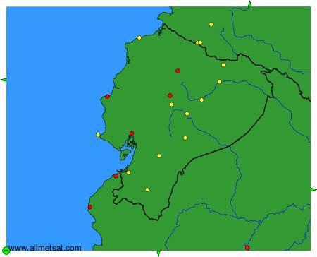
To change the map : click on the green buttons with a black cross to zoom in, on the green button with a dash to zoom out, or on the green arrows for adjacent maps.