METAR-TAF
Airports :
Sharurah Domestic Airport
Sharurah, Saudi Arabia
latitude: 17-28N, longitude: 047-07E, elevation: 720 m
Current weather observation
The report was made 54 minutes ago, at 09:00 UTC
Wind 9 kt from the West/Southwest
Temperature 41°C
Humidity 8%
Pressure 1007 hPa
Visibility 10 km or more
no clouds below 1500 m and no cumulonimbus
METAR: OESH 290900Z 24009KT CAVOK 41/00 Q1007 NOSIG
Time: 12:54 (09:54 UTC)
Forecast
The report was made 10 hours and 54 minutes ago, at 23:00 UTC
Forecast valid from 29 at 00 UTC to 30 at 06 UTC
Wind 8 kt from the South/Southwest
Visibility: 7000 m
Probability 30% :
Temporary
from 29 at 00 UTC to 29 at 08 UTC
from 29 at 00 UTC to 29 at 08 UTC
Visibility: 3000 m
widespread dust
Becoming
from 29 at 08 UTC to 29 at 10 UTC
from 29 at 08 UTC to 29 at 10 UTC
Wind 10 kt from the North
Becoming
from 29 at 20 UTC to 29 at 22 UTC
from 29 at 20 UTC to 29 at 22 UTC
Wind 3 kt from variable directions
TAF: OESH 282300Z 2900/3006 20008KT 7000 NSC PROB30 TEMPO 2900/2908 3000 DU BECMG 2908/2910 35010KT BECMG 2920/2922 VRB03KT
Weather observations and forecasts of more than 4000 airports (METAR and TAF reports).
The available stations are represented by yellow and red dots on the map.
Hover mouse over dot to see the name of the station.
Then click to see weather observations and forecasts.
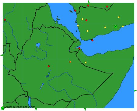
To change the map : click on the green buttons with a black cross to zoom in, on the green button with a dash to zoom out, or on the green arrows for adjacent maps.