METAR-TAF
Airports :
Malabo International Airport
Malabo, Equatorial Guinea
latitude: 03-45-18N, longitude: 08-42-31E, elevation: 23 m
Current weather observation
METAR: FGSL 271200Z 29004KT 240V330 9999 SCT008 30/26 Q1015 NOSIG
Time: 13:32 (12:32 UTC)
Forecast
from 26 at 06 UTC to 26 at 09 UTC
Few clouds at a height of 1800 ft, Cumulonimbus.
from 26 at 13 UTC to 26 at 17 UTC
Few clouds at a height of 1800 ft, Cumulonimbus.
from 26 at 18 UTC to 26 at 23 UTC
Scattered clouds at a height of 1800 ft, Cumulonimbus.
TAF: FGSL 260500Z 2606/2712 25004KT 9999 SCT008 PROB40 TEMPO 2606/2609 4000 TSRA BKN008 FEW018CB PROB30 TEMPO 2613/2617 4000 TSRA BKN008 FEW018CB PROB30 TEMPO 2618/2623 TS BKN008 SCT018CB
Weather observations and forecasts of more than 4000 airports (METAR and TAF reports).
The available stations are represented by yellow and red dots on the map.
Hover mouse over dot to see the name of the station.
Then click to see weather observations and forecasts.
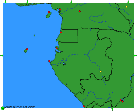
To change the map : click on the green buttons with a black cross to zoom in, on the green button with a dash to zoom out, or on the green arrows for adjacent maps.