METAR-TAF
Airports :
Douala International Airport
Douala, Cameroon
latitude: 04-00N, longitude: 009-44E, elevation: 10 m
Current weather observation
The report was made 48 minutes ago, at 17:00 UTC
Wind 2 kt from variable directions
Temperature 26°C
Humidity 89%
Pressure 1013 hPa
Visibility 10 km or more
Scattered clouds at a height of 300 ft
Broken clouds at a height of 1000 ft
Few clouds at a height of 1300 ft, Cumulonimbus.
Broken clouds at a height of 1000 ft
Few clouds at a height of 1300 ft, Cumulonimbus.
light drizzle
METAR: FKKD 151700Z VRB02KT 9999 -DZ SCT003 BKN010 FEW013CB 26/24 Q1013 TEMPO 2500 RADZ
Time: 18:48 (17:48 UTC)
Forecast
The report was made 48 minutes ago, at 17:00 UTC
Forecast valid from 15 at 18 UTC to 16 at 24 UTC
Wind 2 kt from variable directions
Visibility: 6000 m
Scattered clouds at a height of 400 ft
Broken clouds at a height of 1000 ft
Few clouds at a height of 1300 ft, Cumulonimbus.
Broken clouds at a height of 1000 ft
Few clouds at a height of 1300 ft, Cumulonimbus.
light rain, drizzle
Temporary
from 15 at 18 UTC to 15 at 24 UTC
from 15 at 18 UTC to 15 at 24 UTC
Visibility: 2000 m
thunderstorm, rain, drizzle
Temporary
from 16 at 03 UTC to 16 at 08 UTC
from 16 at 03 UTC to 16 at 08 UTC
Visibility: 2000 m
thunderstorm, rain, drizzle
Temporary
from 16 at 14 UTC to 16 at 18 UTC
from 16 at 14 UTC to 16 at 18 UTC
Visibility: 3000 m
thunderstorm, rain, drizzle,
TAF: FKKD 151700Z 1518/1624 VRB02KT 6000 -RADZ SCT004 BKN010 FEW013CB TEMPO 1518/1524 2000 TSRADZ TEMPO 1603/1608 2000 TSRADZ TEMPO 1614/1618 3000 TSRADZ
Weather observations and forecasts of more than 4000 airports (METAR and TAF reports).
The available stations are represented by yellow and red dots on the map.
Hover mouse over dot to see the name of the station.
Then click to see weather observations and forecasts.
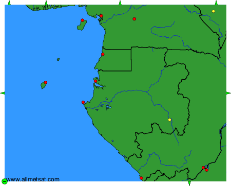
To change the map : click on the green buttons with a black cross to zoom in, on the green button with a dash to zoom out, or on the green arrows for adjacent maps.