METAR-TAF
Airports :
Yaoundé Nsimalen International Airport
Yaoundé, Cameroon
latitude: 03-50N, longitude: 011-31E, elevation: 751 m
Current weather observation
The report was made 50 minutes ago, at 07:00 UTC
Wind 4 kt from the Southwest, varying between South/Southwest and West
Temperature 22°C
Humidity 88%
Pressure 1015 hPa
Visibility: 8000 m
Broken clouds at a height of 600 ft
METAR: FKYS 060700Z 22004KT 200V260 8000 BKN006 22/20 Q1015 NOSIG
Time: 08:50 (07:50 UTC)
Forecast
The report was made 2 hours and 50 minutes ago, at 05:00 UTC
Forecast valid from 06 at 06 UTC to 07 at 06 UTC
Wind 5 kt from the West
Visibility: 8000 m
Broken clouds at a height of 600 ft
Becoming
from 06 at 08 UTC to 06 at 10 UTC
from 06 at 08 UTC to 06 at 10 UTC
Broken clouds at a height of 1600 ft
Temporary
from 06 at 16 UTC to 06 at 20 UTC
from 06 at 16 UTC to 06 at 20 UTC
Wind 15 kt from the East with gusts up to 30 kt
Visibility: 3000 m
Broken clouds at a height of 600 ft
Few clouds at a height of 2300 ft, Cumulonimbus.
Few clouds at a height of 2300 ft, Cumulonimbus.
thunderstorm, rain
Becoming
from 06 at 20 UTC to 06 at 22 UTC
from 06 at 20 UTC to 06 at 22 UTC
Broken clouds at a height of 600 ft
TAF: FKYS 060500Z 0606/0706 26005KT 8000 BKN006 BECMG 0608/0610 BKN016 TEMPO 0616/0620 08015G30KT 3000 TSRA BKN006 FEW023CB BECMG 0620/0622 BKN006
Weather observations and forecasts of more than 4000 airports (METAR and TAF reports).
The available stations are represented by yellow and red dots on the map.
Hover mouse over dot to see the name of the station.
Then click to see weather observations and forecasts.
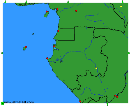
To change the map : click on the green buttons with a black cross to zoom in, on the green button with a dash to zoom out, or on the green arrows for adjacent maps.