METAR-TAF
Airports :
Cairns Army Airfield
Ozark, Alabama, United States
latitude: 31-17N, longitude: 085-43W, elevation: 298 ft
Current weather observation
METAR: KOZR 310755Z AUTO 00000KT 10SM CLR 24/23 A2993 RMK AO2 SLP133 T02360225 $
Time: 03:31 (08:31 UTC)
Forecast
Scattered clouds at a height of 5000 ft, Cumulonimbus.
Broken clouds at a height of 25000 ft
from 31 at 03 UTC to 31 at 04 UTC
Scattered clouds at a height of 2000 ft
Broken clouds at a height of 25000 ft
from 31 at 07 UTC to 31 at 12 UTC
from 31 at 13 UTC to 31 at 14 UTC
Broken clouds at a height of 25000 ft
from 31 at 19 UTC to 31 at 20 UTC
Broken clouds at a height of 12000 ft
Overcast at a height of 25000 ft
from 31 at 22 UTC to 31 at 24 UTC
Broken clouds at a height of 2000 ft, Cumulonimbus.
Overcast at a height of 10000 ft
from 01 at 01 UTC to 01 at 02 UTC
Scattered clouds at a height of 3500 ft
Broken clouds at a height of 25000 ft
from 01 at 05 UTC to 01 at 06 UTC
TAF: KOZR 310200Z 3102/0108 VRB05KT 9999 VCTS FEW007 SCT050CB BKN250 QNH2992INS BECMG 3103/3104 VRB05KT 9999 NSW SCT007 SCT020 BKN250 QNH2994INS TEMPO 3107/3112 4800 BR BKN007 BECMG 3113/3114 26007KT 9999 SCT020 BKN250 QNH2993INS BECMG 3119/3120 23007KT 9999 VCTS BKN050CB BKN120 OVC250 QNH2989INS TEMPO 3122/3124 VRB18G28KT 3200 +TSRA SCT015 BKN020CB OVC100 BECMG 0101/0102 VRB06KT 9999 NSW FEW010 SCT035 BKN250 QNH2990INS BECMG 0105/0106 23006KT 4800 BR BKN005 QNH2989INS TX35/3120Z TN25/3110Z LAST NO AMDS AFT 3106 NEXT 3108
Weather observations and forecasts of more than 4000 airports (METAR and TAF reports).
The available stations are represented by yellow and red dots on the map.
Hover mouse over dot to see the name of the station.
Then click to see weather observations and forecasts.
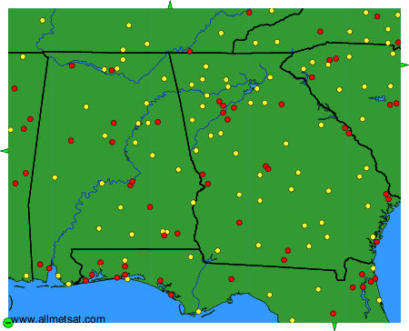
To change the map : click on the green buttons with a black cross to zoom in, on the green button with a dash to zoom out, or on the green arrows for adjacent maps.