METAR-TAF
Airports :
Valparaiso
Aiken
Alabaster
Albany
Alexander City
Alma
Americus
Andalusia
Anderson
Andrews
Anniston
Apalachicola
Asheville
Athens
Athens
Atlanta
Atlanta
Atlanta
Atlanta
Atlanta
Atlanta / Kennesaw
Auburn
Augusta
Augusta
Bainbridge
Bessemer
Birmingham
Brunswick
Brunswick
Calhoun
Canton
Carrollton
Cartersville
Charlotte
Chattanooga
Clemson
Columbia-Metropolitan
Columbia-Owens
Columbus
Columbus
Columbus / West Point / Starkville
Cordele
Corinth
Cornelia
Crestview
Cross City
Dalton
Decatur
Demopolis
Destin
Dothan
Douglas
Dublin
Duke Field
Eastman
Eufaula
Evergreen
Fairhope
Fayetteville
Fernandina Beach
Fort Benning / Columbus
Fort Payne
Fort Rucker
Fort Rucker
Franklin
Gadsden
Gainesville
Gainesville
Gastonia
Gatlinburg
Greenville
Greenville
Greenville
Greenwood
Greer
Gulf Shores
Hickory
Hinesville
Homerville
Huntsville
Huntsville
Jacksonville-Cecil
Jacksonville-Craig
Jacksonville Intl.
Jacksonville-NAS
Jasper
Jasper
Knoxville
Lagrange
Lake City
Lawrenceville
Lincolnton
Macon
Marianna
Marietta
Mary Esther
Mayport
Meridian
Meridian
Milledgeville
Milton
Milton
Mobile-downtown
Mobile-regional
Montgomery-Maxwell-Gunter
Montgomery-regional
Morganton
Moultrie
Muscle Shoals
Newberry
Newnan
Ozark
Panama City
Parsons
Pascagoula
Pell City
Pensacola
Pensacola NAS
Perry
Perry
Pickens
Redstone Arsenal
Rock Hill
Rome
Rutherfordton
Savannah
Savannah
Selma
Shelby
Shelbyville
Spartanburg
Starkville
Statesboro
Statesville
St. Augustine
Sylacauga
Sylvania
Talladega
Tallahassee
Thomaston
Thomson
Troy
Tupelo
Tuscaloosa
Tyndall AFB
Valdosta
Valdosta
Valparaiso
Vidalia
Warner Robins
Waycross
Winchester
Winder
Winnsboro
Georgia, Alabama
Alabama
Florida
Kentucky
Mississippi
North America
North Carolina
South Carolina
Tennessee
Destin–Fort Walton Beach Airport Valparaiso, Florida, United States
latitude: 30-29N, longitude: 086-31W, elevation: 85 ft
Current weather observation The report was made 37 minutes ago, at 11:55 UTC
Wind 5 mph from the West
Temperature 82 °F
Humidity 94 %
Pressure 29.89 in. Hg
Visibility: 10 miles
Clear sky
METAR: KVPS 301155Z AUTO 28004KT 10SM CLR 28/27 A2989 RMK AO2 LTG DSNT SE-S SLP127 T02820269 10283 20260 55003 $
Time: 07:32 (12:32 UTC) Forecast The report was made 3 hours and 32 minutes ago, at 09:00 UTC
Forecast valid from 30 at 09 UTC to 31 at 15 UTC
Wind 10 mph from the West/Northwest
Visibility 6.2 miles or more
Scattered clouds at a height of 4000 ft Broken clouds at a height of 6000 ft
Temporary
Broken clouds at a height of 2000 ft, Cumulonimbus.
thunderstorm, light rain
Becoming
Wind 12 mph from the West
Visibility: 26246 ft
Scattered clouds at a height of 4000 ft, Cumulonimbus. Broken clouds at a height of 6000 ft
light rain showers, thunderstorm in vicinity
Temporary
Wind 23 mph from the West with gusts up to 35 mph
Visibility: 15748 ft
Broken clouds at a height of 4000 ft, Cumulonimbus.
thunderstorm, rain
Becoming
Wind 10 mph from the West
Visibility 6.2 miles or more
Scattered clouds at a height of 5000 ft Broken clouds at a height of 6000 ft
TAF: KVPS 300900Z 3009/3115 30009KT 9999 SCT040 BKN060 QNH2986INS TEMPO 3009/3011 -TSRA BKN020CB BECMG 3018/3019 26010KT 8000 -SHRA VCTS SCT040CB BKN060 QNH2991INS TEMPO 3019/3101 26020G30KT 4800 TSRA BKN040CB BECMG 3104/3105 28009KT 9999 NSW SCT050 BKN060 QNH2995INS TX36/3017Z TN27/3011Z
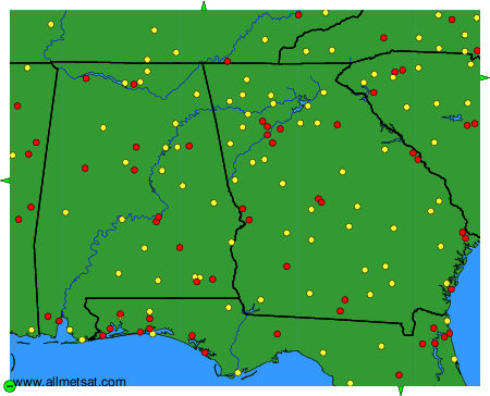
Weather observations and forecasts of more than 4000 airports (METAR and TAF reports).
The available stations are represented by yellow and red dots on the map.
Hover mouse over dot to see the name of the station.
Then click to see weather observations and forecasts.
To change the map : click on the green buttons with a black cross to zoom in, on the green button with a dash to zoom out, or on the green arrows for adjacent maps.