METAR-TAF
Airports :
Juan Manuel Gálvez International Airport
Roatán, Honduras
latitude: 16-19N, longitude: 086-31W, elevation: 5 m
Current weather observation
The report was made 5 minutes ago, at 21:00 UTC
Wind 18 kt from the East with gusts up to 28 kt
Temperature 28°C
Humidity 84%
Pressure 1015 hPa
Visibility 10 km or more
Few clouds at a height of 1800 ft
Few clouds at a height of 2000 ft, Cumulonimbus.
Broken clouds at a height of 8000 ft
Few clouds at a height of 2000 ft, Cumulonimbus.
Broken clouds at a height of 8000 ft
METAR: MHRO 252100Z 08018G28KT 9999 FEW018 FEW020CB BKN080 28/25 Q1015 A2997 NOSIG RMK CB NE
Time: 15:05 (21:05 UTC)
Forecast
The report was made 4 hours and 15 minutes ago, at 16:50 UTC
Forecast valid from 25 at 18 UTC to 26 at 18 UTC
Wind 16 kt from the East
Visibility 10 km or more
Scattered clouds at a height of 2400 ft
Probability 40% :
Temporary
from 25 at 18 UTC to 26 at 21 UTC
from 25 at 18 UTC to 26 at 21 UTC
Visibility: 3000 m
Scattered clouds at a height of 2000 ft, Towering cumulus.
Few clouds at a height of 2200 ft, Cumulonimbus.
Few clouds at a height of 2200 ft, Cumulonimbus.
TAF: MHRO 251650Z 2518/2618 09016KT 9999 SCT024 TX30/2519Z TN27/2612Z PROB40 TEMPO 2518/2621 3000 +TSSHRA SCT020TCU FEW022CB
Weather observations and forecasts of more than 4000 airports (METAR and TAF reports).
The available stations are represented by yellow and red dots on the map.
Hover mouse over dot to see the name of the station.
Then click to see weather observations and forecasts.
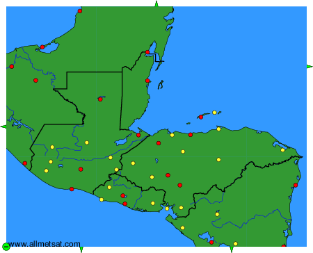
To change the map : click on the green buttons with a black cross to zoom in, on the green button with a dash to zoom out, or on the green arrows for adjacent maps.