METAR-TAF
Airports :
Chetumal International Airport
Chetumal, Mexico
latitude: 18-29N, longitude: 088-18W, elevation: 9 m
Current weather observation
The report was made 8 hours and 46 minutes ago, at 02:45 UTC
Wind 5 kt from the East
Temperature 28°C
Humidity 74%
Pressure 1014 hPa
Visibility: 11.3 km
Scattered clouds at a height of 2000 ft
METAR: MMCM 210245Z 08005KT 7SM SCT020 28/23 A2994 RMK SLP139 5//// 9// 8/500 HZY
Time: 06:31 (11:31 UTC)
Forecast
The report was made 6 hours and 1 minutes ago, at 05:30 UTC
Forecast valid from 21 at 06 UTC to 22 at 06 UTC
Wind 10 kt from the East
Visibility: 10 km
Scattered clouds at a height of 2000 ft
Temporary
from 21 at 12 UTC to 21 at 16 UTC
from 21 at 12 UTC to 21 at 16 UTC
Visibility: 6.4 km
Broken clouds at a height of 1000 ft
haze
From 21 at 1600 UTC
Wind 10 kt from the East
Visibility: 10 km
Broken clouds at a height of 1500 ft
From 22 at 0000 UTC
Wind 5 kt from the East
Visibility: 10 km
Scattered clouds at a height of 1500 ft
TAF: MMCM 210530Z 2106/2206 09010KT P6SM SCT020 TEMPO 2112/2116 4SM HZ BKN010 FM211600 09010KT P6SM BKN015 FM220000 09005KT P6SM SCT015
Weather observations and forecasts of more than 4000 airports (METAR and TAF reports).
The available stations are represented by yellow and red dots on the map.
Hover mouse over dot to see the name of the station.
Then click to see weather observations and forecasts.
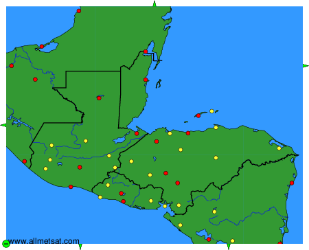
To change the map : click on the green buttons with a black cross to zoom in, on the green button with a dash to zoom out, or on the green arrows for adjacent maps.