METAR-TAF
Airports :
Palenque International Airport
Palenque, Mexico
latitude: 17-32-06N, longitude: 92-00-54W, elevation: 60 m
Current weather observation
The report was made 2 hours and 22 minutes ago, at 00:40 UTC
Wind 5 kt from the East
Temperature 32°C
Humidity 71%
Pressure 1011 hPa
Visibility: 16.1 km
Scattered clouds at a height of 4000 ft, Cumulonimbus.
METAR: MMPQ 010040Z 09005KT 10SM SCT040CB 32/26 A2984 RMK 8/300 CB SE PQE
Time: 22:02 (03:02 UTC)
Forecast
The report was made 9 hours and 46 minutes ago, at 17:16 UTC
Forecast valid from 31 at 18 UTC to 01 at 18 UTC
Wind 10 kt from the East
Visibility: 10 km
Scattered clouds at a height of 4000 ft
From 31 at 2000 UTC
Wind 12 kt from the East
Visibility: 10 km
Scattered clouds at a height of 20000 ft
From 01 at 0300 UTC
Wind 5 kt from the East
Visibility: 10 km
Scattered clouds at a height of 2000 ft
Broken clouds at a height of 20000 ft
Broken clouds at a height of 20000 ft
From 01 at 1400 UTC
Wind 8 kt from the East
Visibility: 10 km
Scattered clouds at a height of 6000 ft
TAF: MMPQ 311716Z 3118/0118 10010KT P6SM SCT040 FM312000 10012KT P6SM SCT200 FM010300 10005KT P6SM SCT020 BKN200 FM011400 10008KT P6SM SCT060
Weather observations and forecasts of more than 4000 airports (METAR and TAF reports).
The available stations are represented by yellow and red dots on the map.
Hover mouse over dot to see the name of the station.
Then click to see weather observations and forecasts.
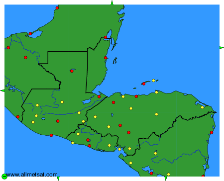
To change the map : click on the green buttons with a black cross to zoom in, on the green button with a dash to zoom out, or on the green arrows for adjacent maps.