METAR-TAF
Airports :
Bluefields Airport
Bluefields, Nicaragua
latitude: 12-00N, longitude: 083-46W, elevation: 5 m
Current weather observation
The report was made 7 hours and 21 minutes ago, at 23:00 UTC
Wind 4 kt from the Northeast
Temperature 28°C
Humidity 84%
Pressure 1010 hPa
Visibility 10 km or more
Scattered clouds at a height of 1700 ft
Scattered clouds at a height of 7000 ft
Scattered clouds at a height of 7000 ft
METAR: MNBL 162300Z 05004KT 9999 SCT017 SCT070 28/25 Q1010
Time: 00:21 (06:21 UTC)
Forecast
The report was made 8 hours and 46 minutes ago, at 21:35 UTC
Forecast valid from 17 at 00 UTC to 17 at 24 UTC
Wind 16 kt from the East/Northeast with gusts up to 26 kt
Visibility: 6000 m
Broken clouds at a height of 1700 ft
Scattered clouds at a height of 7000 ft
Scattered clouds at a height of 7000 ft
Temporary
from 17 at 03 UTC to 17 at 10 UTC
from 17 at 03 UTC to 17 at 10 UTC
Wind 10 kt from the East/Northeast with gusts up to 20 kt
Visibility: 8000 m
Broken clouds at a height of 1700 ft
in the vicinity, rain
TAF: MNBL 162135Z 1700/1724 06016G26KT 6000 VCRA/-RA BKN017 SCT070 TEMPO 1703/1710 07010G20KT 8000 VCRA BKN017
Weather observations and forecasts of more than 4000 airports (METAR and TAF reports).
The available stations are represented by yellow and red dots on the map.
Hover mouse over dot to see the name of the station.
Then click to see weather observations and forecasts.
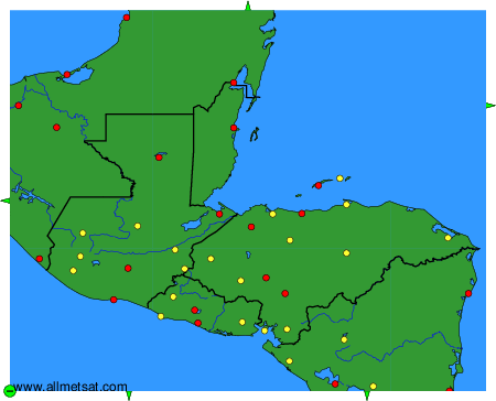
To change the map : click on the green buttons with a black cross to zoom in, on the green button with a dash to zoom out, or on the green arrows for adjacent maps.