METAR-TAF
Airports :
San Salvador
Acajutla
Amapala
Belize City
Bluefields
Campeche
Catacamas
Chetumal
Chinandega
Choluteca
Ciudad Del Carmen
Cobán
Comayagua
El Salvador
Esquipulas
Flores
Guanaja
Guatemala City
Huehuetenango
Jinotega
Juigalpa
La Ceiba
La Esperanza
Managua
Palenque
Puerto Barrios
Puerto Cabezas
Puerto Lempira
Puerto San José
Quetzaltenango
Retalhuleu
Roatán
San Miguel
San Pedro Sula
San Salvador
Santa Ana
Santa Rosa de Copán
Tapachula
Tegucigalpa
Tela
Trujillo
Villahermosa
Yoro
Zacapa
Guatemala, Belize, El Salvador, Honduras
Costa Rica
Cuba
Galápagos
Jamaica
Mexico
Mexico, East
Nicaragua
North America
Panama
Ilopango International Airport San Salvador, El Salvador
latitude: 13-42N, longitude: 089-07W, elevation: 616 m
Current weather observation The report was made 1 hour and 1 minutes ago, at 00:00 UTC
Wind 7 kt from the South/Southeast
Temperature 26 °C
Humidity 79 %
Pressure 1014 hPa
Visibility 10 km or more
no clouds below 1500 m and no cumulonimbus
METAR: MSSS 130000Z 16007KT CAVOK 26/22 Q1013 A2994 NOSIG
Time: 19:01 (01:01 UTC) Forecast The report was made 3 hours and 36 minutes ago, at 21:25 UTC
Forecast valid from 13 at 00 UTC to 13 at 24 UTC
Wind 5 kt from the South
Visibility 10 km or more
Few clouds at a height of 2000 ft Few clouds at a height of 3700 ft, Cumulonimbus.
From 13 at 0500 UTC
Wind 5 kt from the North/Northwest
Visibility 10 km or more
Scattered clouds at a height of 4700 ft
From 13 at 0800 UTC
Wind 5 kt from the North
Visibility 10 km or more
Few clouds at a height of 2000 ft
From 13 at 1800 UTC
Wind 10 kt from the South
Visibility 10 km or more
Scattered clouds at a height of 2700 ft Few clouds at a height of 3700 ft, Cumulonimbus.
TAF: MSSS 122125Z 1300/1324 18005KT 9999 FEW020 FEW037CB TX31/1319Z TN21/1311Z FM130500 34005KT 9999 SCT047 FM130800 35005KT 9999 FEW020 FM131800 18010KT 9999 SCT027 FEW037CB
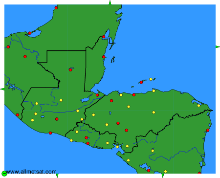
Weather observations and forecasts of more than 4000 airports (METAR and TAF reports).
The available stations are represented by yellow and red dots on the map.
Hover mouse over dot to see the name of the station.
Then click to see weather observations and forecasts.
To change the map : click on the green buttons with a black cross to zoom in, on the green button with a dash to zoom out, or on the green arrows for adjacent maps.