METAR-TAF
Airports :
Kapalua Airport
Lahaina, Hawaii, United States
latitude: 21-01N, longitude: 156-38W, elevation: 131 ft
METAR: missing
Time: 05:52 (15:52 UTC)
Forecast
The report was made 14 hours and 54 minutes ago, at 00:58 UTC
Forecast valid from 31 at 01 UTC to 31 at 24 UTC
Wind 14 mph from the East/Northeast with gusts up to 24 mph
Visibility: 6 miles
Few clouds at a height of 3000 ft
Scattered clouds at a height of 5000 ft
Scattered clouds at a height of 5000 ft
showers in vicinity
From 31 at 0600 UTC
Wind 7 mph from variable directions
Visibility: 6 miles
Few clouds at a height of 2000 ft
Scattered clouds at a height of 3000 ft
Scattered clouds at a height of 3000 ft
From 31 at 2000 UTC
Wind 17 mph from the Northeast
Visibility: 6 miles
Few clouds at a height of 4500 ft
TAF: PHJH 310058Z 3101/3124 07012G21KT P6SM VCSH FEW030 SCT050 FM310600 VRB06KT P6SM FEW020 SCT030 FM312000 04015KT P6SM FEW045
Weather observations and forecasts of more than 4000 airports (METAR and TAF reports).
The available stations are represented by yellow and red dots on the map.
Hover mouse over dot to see the name of the station.
Then click to see weather observations and forecasts.
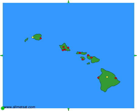
To change the map : click on the green buttons with a black cross to zoom in, on the green button with a dash to zoom out, or on the green arrows for adjacent maps.