METAR-TAF
Airports :
Pohakuloa Training Area
Bradshaw, Hawaii, United States
latitude: 19-47N, longitude: 155-33W, elevation: 6189 ft
Current weather observation
The report was made 43 minutes ago, at 10:55 UTC
Calm wind
Temperature 52°F
Humidity 76%
Pressure 30.31 in. Hg
Visibility: 10 miles
Clear sky
METAR: PHSF 291055Z AUTO 00000KT 10SM CLR 11/07 A3031 RMK AO2 SLP138 T01100069 $
Time: 01:38 (11:38 UTC)
TAF: missing
Weather observations and forecasts of more than 4000 airports (METAR and TAF reports).
The available stations are represented by yellow and red dots on the map.
Hover mouse over dot to see the name of the station.
Then click to see weather observations and forecasts.
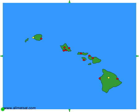
To change the map : click on the green buttons with a black cross to zoom in, on the green button with a dash to zoom out, or on the green arrows for adjacent maps.