METAR-TAF
Airports :
Reykjavík Airport
Reykjavík, Iceland
latitude: 64-08N, longitude: 021-54W, elevation: 54 m
Current weather observation
The report was made 43 minutes ago, at 09:00 UTC
Wind 10 kt from the East
Temperature 10°C
Humidity 100%
Pressure 1003 hPa
Visibility 10 km or more
Scattered clouds at a height of 2000 ft
Broken clouds at a height of 5600 ft
Overcast at a height of 9000 ft
Broken clouds at a height of 5600 ft
Overcast at a height of 9000 ft
light rain
METAR: BIRK 270900Z 10010KT 9999 -RA SCT020 BKN056 OVC090 10/10 Q1003
Time: 09:43 (09:43 UTC)
Forecast
The report was made 1 hour and 52 minutes ago, at 07:51 UTC
Forecast valid from 27 at 09 UTC to 28 at 09 UTC
Wind 11 kt from the East
Visibility 10 km or more
Scattered clouds at a height of 2400 ft
Broken clouds at a height of 4000 ft
Broken clouds at a height of 4000 ft
light rain
Temporary
from 27 at 09 UTC to 27 at 13 UTC
from 27 at 09 UTC to 27 at 13 UTC
Broken clouds at a height of 1200 ft
rain
Becoming
from 27 at 19 UTC to 27 at 21 UTC
from 27 at 19 UTC to 27 at 21 UTC
Wind 5 kt from the North/Northeast
Temporary
from 27 at 22 UTC to 28 at 05 UTC
from 27 at 22 UTC to 28 at 05 UTC
Visibility: 3000 m
Broken clouds at a height of 800 ft
rain, drizzle, mist
TAF: BIRK 270751Z 2709/2809 10011KT 9999 -RA SCT024 BKN040 TX12/2715Z TN10/2806Z TEMPO 2709/2713 RA BKN012 BECMG 2719/2721 02005KT TEMPO 2722/2805 3000 RADZ BR BKN008
Weather observations and forecasts of more than 4000 airports (METAR and TAF reports).
The available stations are represented by yellow and red dots on the map.
Hover mouse over dot to see the name of the station.
Then click to see weather observations and forecasts.
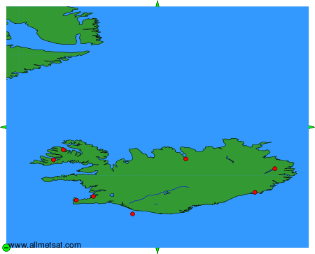
To change the map : click on the green buttons with a black cross to zoom in, on the green button with a dash to zoom out, or on the green arrows for adjacent maps.