METAR-TAF
Airports :
Missoula
Afton
Baker City
Big Piney / Marbleton
Boise
Bozeman
Burley
Butte
Caldwell
Challis
Coeur d'Alene
Deer Park
Dillon
Driggs
Grangeville
Great Falls
Great Falls
Hailey
Helena
Idaho Falls
Jackson
Jerome
Kalispell Glacier Park
La Grande
Lewiston
Livingston
Lowell
McCall
Missoula
Mountain Home
Mullan Pass Vor
Nampa
Ontario
Pocatello
Pullman / Moscow
Rexburg
Rome
Salmon
Sandpoint
Spokane
Spokane
Spokane
Stanley
Twin Falls
West Yellowstone
Yellowstone Lake
Idaho
Alberta
British Columbia
Montana, East
Montana, West
Nevada
North America
Oregon
Utah
Washington
Wyoming
Missoula International Airport Missoula, Montana, United States
latitude: 46-55-15N, longitude: 114-05-33W, elevation: 3198 ft
Current weather observation The report was made 54 minutes ago, at 00:53 UTC
Wind 3 mph from the North/Northeast
Temperature 48 °F
Humidity 66 %
Pressure 29.91 in. Hg
Visibility: 10 miles
Broken clouds at a height of 4100 ft Broken clouds at a height of 5000 ft
METAR: KMSO 140053Z 03003KT 10SM BKN041 BKN050 09/03 A2991 RMK AO2 PK WND 27033/2354 RAB17E41 SLP132 P0000 T00940028 $
Time: 19:47 (01:47 UTC) Forecast The report was made 2 hours and 27 minutes ago, at 23:20 UTC
Forecast valid from 14 at 00 UTC to 14 at 24 UTC
Wind 23 mph from the West with gusts up to 35 mph
Visibility: 6 miles
Broken clouds at a height of 4000 ft Overcast at a height of 5000 ft
light rain showers
From 14 at 0300 UTC
Wind 14 mph from the West/Southwest with gusts up to 25 mph
Visibility: 6 miles
Few clouds at a height of 3000 ft Overcast at a height of 4000 ft
light rain showers
From 14 at 0700 UTC
Wind 13 mph from the West
Visibility: 6 miles
Overcast at a height of 5000 ft
From 14 at 1500 UTC
Wind 14 mph from the West with gusts up to 25 mph
Visibility: 6 miles
Broken clouds at a height of 5000 ft
From 14 at 1900 UTC
Wind 21 mph from the West/Northwest with gusts up to 32 mph
Visibility: 6 miles
Scattered clouds at a height of 6000 ft Broken clouds at a height of 8000 ft
TAF: KMSO 132320Z 1400/1424 28020G30KT P6SM -SHRA BKN040 OVC050 FM140300 25012G22KT P6SM -SHRA FEW030 OVC040 FM140700 28011KT P6SM OVC050 FM141500 28012G22KT P6SM BKN050 FM141900 29018G28KT P6SM SCT060 BKN080
Weather observations and forecasts of more than 4000 airports (METAR and TAF reports).
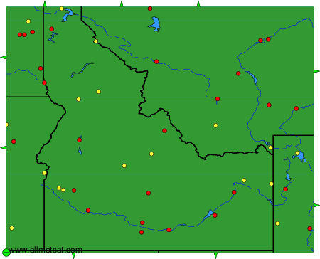
The available stations are represented by yellow and red dots on the map.
Hover mouse over dot to see the name of the station.
Then click to see weather observations and forecasts.
To change the map : click on the green buttons with a black cross to zoom in, on the green button with a dash to zoom out, or on the green arrows for adjacent maps.
