METAR: CYQG 242000Z AUTO 17009G15KT 9SM OVC120 23/10 A3007 RMK SLP183 DENSITY ALT 1600FT
Time: 16:52 (20:52 UTC)
Forecast
The report was made 3 hours and 12 minutes ago, at 17:40 UTC
Forecast valid from 24 at 18 UTC to 25 at 18 UTC
Wind 6 mph from the South
Visibility: 6 miles
Few clouds at a height of 7000 ft Broken clouds at a height of 15000 ft
Becoming from 24 at 18 UTC to 24 at 20 UTC
Broken clouds at a height of 7000 ft Broken clouds at a height of 15000 ft
From 24 at 2200 UTC
Wind 6 mph from the East
Visibility: 6 miles
Broken clouds at a height of 5000 ft Overcast at a height of 10000 ft
Temporary from 24 at 22 UTC to 24 at 24 UTC
Visibility: 6 miles
light rain showers
From 25 at 0500 UTC
Wind 6 mph from the East/Southeast
Visibility: 6 miles
Overcast at a height of 3000 ft
light rain showers
Temporary from 25 at 05 UTC to 25 at 11 UTC
Visibility: 6 miles
Scattered clouds at a height of 3000 ft Overcast at a height of 6000 ft
From 25 at 1100 UTC
Wind 6 mph from the Southwest
Visibility: 6 miles
Overcast at a height of 2000 ft
From 25 at 1500 UTC
Wind 12 mph from the West
Visibility: 6 miles
Few clouds at a height of 2000 ft Broken clouds at a height of 3000 ft
TAF: CYQG 241740Z 2418/2518 19005KT P6SM FEW070 BKN150 BECMG 2418/2420 BKN070 BKN150 FM242200 08005KT P6SM BKN050 OVC100 TEMPO 2422/2424 P6SM -SHRA FM250500 11005KT P6SM -SHRA OVC030 TEMPO 2505/2511 P6SM NSW SCT030 OVC060 FM251100 23005KT P6SM OVC020 FM251500 26010KT P6SM FEW020 BKN030 RMK FCST BASED ON AUTO OBS. NXT FCST BY 250000Z
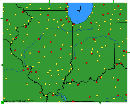
Weather observations and forecasts of more than 4000 airports (METAR and TAF reports).
The available stations are represented by yellow and red dots on the map.
Hover mouse over dot to see the name of the station.
Then click to see weather observations and forecasts.
To change the map : click on the green buttons with a black cross to zoom in, on the green button with a dash to zoom out, or on the green arrows for adjacent maps.