METAR-TAF
Airports :
Dayton
Adrian
Alton / St. Louis
Anderson
Angola
Auburn
Aurora
Battle Creek
Belleville
Benton Harbor
Bloomington
Bloomington / Normal
Bowling Green
Burlington
Burlington
Cahokia / St. Louis
Cairo
Cape Girardeau
Carbondale / Murphysboro
Carmi
Cedar Rapids
Centralia
Champaign / Urbana
Charlotte
Chicago
Chicago-Midway
Cincinnati
Clarksville
Clinton
Coldwater
Columbus
Covington
Crawfordsville
Danville
Danville
Davenport
Dayton
Dayton
Dayton
Decatur
Defiance
DeKalb
Dubuque
Effingham
Elkhart
Evansville
Fairfield
Fairfield
Farmington
Flora
Fort Knox
Fort Madison
Fort Wayne
Frankfort
Freeport
Galesburg
Gary
Glasgow
Goshen
Grand Rapids
Hamilton
Hannibal
Harrisburg
Henderson
Hillsdale
Holland
Hopkinsville
Independence
Indianapolis
Indianapolis
Indianapolis
Indianapolis
Iowa City
Jackson
Jacksonville
Janesville
Jasper County
Joliet
Kalamazoo / Battle Creek
Kankakee
Kenosha
Keokuk
Kokomo
Lacon
Lafayette
Lansing
Lansing
Lawrenceville
Lexington
Lima
Lincoln
Litchfield
London
Louisville
Louisville
Macomb
Madison
Malden
Marion
Marshall
Mason
Mattoon / Charleston
Metropolis
Milwaukee
Mineral Point
Moline
Monroe
Monticello
Monticello
Morris
Mount Carmel
Mount Pleasant
Mount Vernon
Muncie
Murray
Muscatine
Oelwein
Olney-Noble
Owensboro
Owosso
Paducah
Paris
Peoria
Peru
Peru / LaSalle
Pittsfield
Platteville
Pontiac
Poplar Bluff
Quincy
Racine
Rantoul
Robinson
Rochelle
Rockford
Rolla
Romeoville
Saint Charles
Salem
Savanna
Shelbyville
Sikeston
Somerset
South Bend
South Haven
Sparta
Springfield
Sterling / Rock Falls
St. Louis
St. Louis
Sturgis
Taylorville
Terre Haute
Valparaiso
Versailles
Wapakoneta
Warsaw
Washington
Washington
Waukegan
West Chicago
West Plains
Wheeling / Prospect Heights
Illinois, Indiana
Indiana
Iowa
Kentucky
Michigan
Missouri
North America
Ohio
Tennessee
Wisconsin
Wright-Patterson Air Force Base Dayton, Ohio, United States
latitude: 39-50N, longitude: 084-03W, elevation: 823 ft
Current weather observation The report was made 27 minutes ago, at 12:32 UTC
Wind 3 mph from the South
Temperature 72 °F
Humidity 88 %
Pressure 29.70 in. Hg
Visibility: 10 miles
Broken clouds at a height of 1000 ft Overcast at a height of 2600 ft
METAR: KFFO 021232Z 19003KT 10SM BKN010 OVC026 22/20 A2970 RMK AO2A SLP054
Time: 08:59 (12:59 UTC) Forecast The report was made 1 hour and 59 minutes ago, at 11:00 UTC
Forecast valid from 02 at 11 UTC to 03 at 17 UTC
Wind 10 mph from the Southwest
Visibility 6.2 miles or more
Scattered clouds at a height of 700 ft Broken clouds at a height of 6000 ft
showers in vicinity
Temporary
Broken clouds at a height of 700 ft Broken clouds at a height of 1200 ft Overcast at a height of 6000 ft
Becoming
Wind 10 mph from the South/Southwest
Visibility 6.2 miles or more
Broken clouds at a height of 1000 ft Overcast at a height of 1500 ft
Becoming
Wind 10 mph from the Southwest , varying between South and West
Visibility: 26246 ft
Scattered clouds at a height of 1500 ft Broken clouds at a height of 4000 ft
light rain showers
Temporary
Wind 14 mph from variable directions with gusts up to 21 mph
Visibility: 19685 ft
Broken clouds at a height of 1500 ft, Cumulonimbus. Overcast at a height of 4000 ft
thunderstorm, light rain
Becoming
Wind 14 mph from the Northwest
Visibility 6.2 miles or more
Broken clouds at a height of 4000 ft
Becoming
Wind 10 mph from the North
Visibility 6.2 miles or more
Broken clouds at a height of 1500 ft Overcast at a height of 2500 ft
Becoming
Wind 10 mph from the North/Northeast
Visibility 6.2 miles or more
Broken clouds at a height of 800 ft Overcast at a height of 1200 ft
TAF: KFFO 021100Z 0211/0317 22009KT 9999 VCSH SCT007 BKN060 QNH2969INS TEMPO 0211/0214 BKN007 BKN012 OVC060 BECMG 0212/0214 20009KT 9999 NSW BKN010 OVC015 QNH2970INS BECMG 0214/0216 23009KT 8000 -SHRA SCT015 BKN040 510102 QNH2969INS WND 170V280 TEMPO 0219/0223 VRB12G18KT 6000 -TSRA BKN015CB OVC040 BECMG 0222/0223 32012KT 9999 NSW BKN040 QNH2970INS BECMG 0301/0303 01009KT 9999 BKN015 OVC025 QNH2977INS BECMG 0304/0305 02009KT 9999 BKN008 OVC012 QNH2978INS TX27/0220Z TN19/0310Z
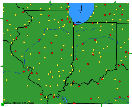
Weather observations and forecasts of more than 4000 airports (METAR and TAF reports).
The available stations are represented by yellow and red dots on the map.
Hover mouse over dot to see the name of the station.
Then click to see weather observations and forecasts.
To change the map : click on the green buttons with a black cross to zoom in, on the green button with a dash to zoom out, or on the green arrows for adjacent maps.