METAR: KUIN 011029Z AUTO 24004KT 10SM BKN006 BKN010 OVC024 18/18 A2964 RMK AO2 CIG 003V008 T01830178 TSNO $
Time: 05:41 (10:41 UTC)
Forecast
The report was made 1 hour and 52 minutes ago, at 08:49 UTC
Forecast valid from 01 at 09 UTC to 02 at 06 UTC
Wind 9 mph from the West/Northwest
Visibility: 5 miles
Overcast at a height of 700 ft
mist, showers in vicinity
Temporary from 01 at 09 UTC to 01 at 12 UTC
Visibility: 2 miles
Overcast at a height of 500 ft
rain showers
From 01 at 1600 UTC
Wind 18 mph from the North/Northwest with gusts up to 28 mph
Visibility: 6 miles
Overcast at a height of 700 ft
mist
Temporary from 01 at 16 UTC to 01 at 20 UTC
Visibility: 3 miles
Overcast at a height of 500 ft
rain showers
From 02 at 0200 UTC
Wind 12 mph from the North
Visibility: 6 miles
Overcast at a height of 700 ft
TAF: KUIN 010849Z 0109/0206 30008KT 5SM BR VCSH OVC007 TEMPO 0109/0112 2SM SHRA OVC005 FM011600 34016G24KT 6SM BR OVC007 TEMPO 0116/0120 3SM SHRA OVC005 FM020200 36010KT P6SM OVC007
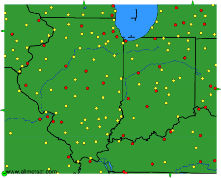
Weather observations and forecasts of more than 4000 airports (METAR and TAF reports).
The available stations are represented by yellow and red dots on the map.
Hover mouse over dot to see the name of the station.
Then click to see weather observations and forecasts.
To change the map : click on the green buttons with a black cross to zoom in, on the green button with a dash to zoom out, or on the green arrows for adjacent maps.