METAR-TAF
Airports :
Kathmandu
Agartala
Aizawl
Bangkok
Bangkok-Suvarnabhumi
Bhubaneswar
Chennai
Chiang Mai
Chiang Rai
Chittagong
Chumphon
Dhaka
Dibrugarh
Dimapur
Gaya
Guwahati
Gwalior
Hua Hin
Hyderabad
Hyderabad
Imphal
Jabalpur
Jamshedpur
Kathmandu
Khajuraho
Khon Kaen
Kolkata
Kunming
Lampang
Loei
Luang Namtha
Luang Prabang
Lucknow
Mae Hong Son
Mae Sot
Mandalay
Nagpur
Nakhon Ratchasima
Nan
Patna
Pattaya-Rayong
Phetchabun
Phitsanulok
Phrae
Rajahmundry
Ranchi
Shillong
Sukhothai
Tak
Thimphu
Tiruchirapalli
Tirupati
Trat
Udon Thani
Varanasi
Vientiane
Vijayawada
Visakhapatnam
Yangon
India, Nepal, Bhutan, Bangladesh, Myanmar
Asia
Cambodia
China
China, East
India
Indian Ocean islands
Laos
Malaysia
Sri Lanka
Thailand
Vietnam
Tribhuvan International Airport Kathmandu, Nepal
latitude: 27-42N, longitude: 085-22E, elevation: 1337 m
Current weather observation The report was made 23 minutes ago, at 15:00 UTC
Wind 4 kt from the South/Southwest
Temperature 19 °C
Humidity 43 %
Pressure 1017 hPa
Visibility: 7000 m
Few clouds at a height of 1500 ft
METAR: VNKT 291500Z 21004KT 7000 FEW015 19/06 Q1017 NOSIG
Time: 21:08 (15:23 UTC) Forecast The report was made 4 hours and 23 minutes ago, at 11:00 UTC
Forecast valid from 29 at 12 UTC to 30 at 12 UTC
Wind 13 kt from the South/Southwest
Visibility: 6000 m
Few clouds at a height of 2000 ft Scattered clouds at a height of 3000 ft
Becoming from 29 at 14 UTC to 29 at 15 UTC
Wind 4 kt from the West/Southwest
Visibility: 7000 m
Few clouds at a height of 1500 ft Scattered clouds at a height of 10000 ft
Becoming from 30 at 00 UTC to 30 at 02 UTC
Wind 2 kt from variable directions
Visibility: 4000 m
Few clouds at a height of 1000 ft
mist
Probability 30% from 30 at 01 UTC to 30 at 03 UTC
Visibility: 2500 m
mist
Becoming from 30 at 05 UTC to 30 at 06 UTC
Wind 3 kt from the East
Visibility: 6000 m
Few clouds at a height of 1500 ft
Becoming from 30 at 07 UTC to 30 at 09 UTC
Wind 11 kt from the West
Visibility: 8000 m
Few clouds at a height of 2000 ft Scattered clouds at a height of 2500 ft
Probability 30% from 30 at 08 UTC to 30 at 12 UTC
Wind 13 kt from variable directions
Visibility: 5000 m
Few clouds at a height of 2500 ft, Cumulonimbus. Broken clouds at a height of 10000 ft
thunderstorm, light rain
TAF: VNKT 291100Z 2912/3012 20013KT 6000 FEW020 SCT030 BECMG 2914/2915 25004KT 7000 FEW015 SCT100 BECMG 3000/3002 VRB02KT 4000 BR FEW010 PROB30 3001/3003 2500 BR BECMG 3005/3006 10003KT 6000 FEW015 BECMG 3007/3009 26011KT 8000 FEW020 SCT025 PROB30 3008/3012 VRB13KT 5000 -TSRA FEW025CB BKN100
Weather observations and forecasts of more than 4000 airports (METAR and TAF reports).
The available stations are represented by yellow and red dots on the map.
Hover mouse over dot to see the name of the station.
Then click to see weather observations and forecasts.
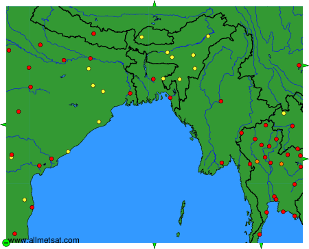
To change the map : click on the green buttons with a black cross to zoom in, on the green button with a dash to zoom out, or on the green arrows for adjacent maps.