METAR-TAF
Airports :
Visakhapatnam
Agartala
Agra
Ahmedabad
Aizawl
Amritsar
Aurangabad
Bahawalpur
Bangalore
Bangalore
Belgaum
Bhavnagar
Bhopal
Bhubaneswar
Chandigarh
Chennai
Chittagong
Coimbatore
Colombo
Dehradun
Dhaka
Dharamsala
Dibrugarh
Dimapur
Gaya
Guwahati
Gwadar
Gwalior
Hambantota
Herat
Hyderabad
Hyderabad
Imphal
Indore
Iranshahr
Islamabad
Jabalpur
Jaipur
Jammu
Jamshedpur
Kabul
Karachi
Kathmandu
Khajuraho
Kochi
Kolkata
Kota
Kozhikode
Kullu / Manali
Lahore
Leh
Lucknow
Madurai
Mandalay
Mangalore
Multan
Mumbai
Mumbai
Mysore
Nagpur
Nawabshah
New Delhi
Panaji
Patna
Peshawar
Rahim Yar Khan
Rajahmundry
Rajkot
Ranchi
Rawalpindi
Shillong
Shimla
Sialkot
Srinagar
Sukkur
Thimphu
Thiruvananthapuram
Thoothukudi
Tiruchirapalli
Tirupati
Udaipur
Vadodara
Varanasi
Vijayawada
Visakhapatnam
Yangon
Zabol
Zahedan
India, Sri Lanka
Afghanistan
Asia
Bahrain
Bangladesh
Bhutan
Cambodia
China
China, East
India
Indian Ocean islands
Iran
Kazakhstan
Kyrgyzstan
Laos
Myanmar
Nepal
Oman
Pakistan
Qatar
Tajikistan
Thailand
Turkmenistan
United Arab Emirates
Uzbekistan
Vietnam
Visakhapatnam Airport Visakhapatnam, India
latitude: 17-43-16N, longitude: 83-13-28E, elevation: 6 m
Current weather observation The report was made 35 minutes ago, at 13:00 UTC
Wind 6 kt from the Southwest
Temperature 29 °C
Humidity 79 %
Pressure 1002 hPa
Visibility: 4500 m
Scattered clouds at a height of 1600 ft Broken clouds at a height of 22000 ft
mist,
METAR: VOVZ 221300Z 23006KT 4500 BR SCT016 BKN220 29/25 Q1002 NOSIG
Time: 19:05 (13:35 UTC) Forecast The report was made 2 hours and 35 minutes ago, at 11:00 UTC
Forecast valid from 22 at 12 UTC to 23 at 18 UTC
Wind 10 kt from the South/Southwest
Visibility: 4500 m
Scattered clouds at a height of 1600 ft Broken clouds at a height of 9000 ft
mist
Becoming from 22 at 15 UTC to 22 at 16 UTC
Wind 10 kt from the Southwest with gusts up to 20 kt
Visibility: 3000 m
Scattered clouds at a height of 1600 ft Few clouds at a height of 2500 ft, Cumulonimbus. Broken clouds at a height of 8000 ft
thunderstorm, rain
Becoming from 23 at 03 UTC to 23 at 04 UTC
Wind 10 kt from the Southwest
Visibility: 5000 m
haze
Temporary from 23 at 06 UTC to 23 at 10 UTC
Wind 15 kt from the West/Northwest with gusts up to 25 kt
Visibility: 3000 m
Scattered clouds at a height of 1600 ft Few clouds at a height of 2500 ft, Cumulonimbus. Broken clouds at a height of 9000 ft
thunderstorm, rain,
TAF: VOVZ 221100Z 2212/2318 21010KT 4500 BR SCT016 BKN090 BECMG 2215/2216 VRB02KT TEPMO 2220/2224 22010G20KT 3000 TSRA SCT016 FEW025CB BKN080 BECMG 2303/2304 23010KT 5000 HZ TEMPO 2306/2310 29015G25KT 3000 TSRA SCT016 FEW025CB BKN090
Weather observations and forecasts of more than 4000 airports (METAR and TAF reports).
The available stations are represented by yellow and red dots on the map.
Hover mouse over dot to see the name of the station.
Then click to see weather observations and forecasts.
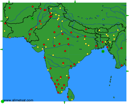
To change the map : click on the green buttons with a black cross to zoom in, on the green button with a dash to zoom out, or on the green arrows for adjacent maps.