METAR-TAF
Airports :
Bujumbura International Airport
Bujumbura, Burundi
latitude: 03-19S, longitude: 029-19E, elevation: 782 m
Current weather observation
The report was made 10 hours and 14 minutes ago, at 04:00 UTC
Wind 2 kt from the East
Temperature 21°C
Humidity 83%
Pressure 1017 hPa
Visibility: 9000 m
Few clouds at a height of 3000 ft
Broken clouds at a height of 10000 ft
Broken clouds at a height of 10000 ft
METAR: HBBA 090400Z 09002KT 9000 FEW030 BKN100 21/18 Q1017 NOSIG
Time: 16:14 (14:14 UTC)
Forecast
The report was made 3 hours and 14 minutes ago, at 11:00 UTC
Forecast valid from 09 at 12 UTC to 10 at 18 UTC
Wind 8 kt from the South with gusts up to 20 kt
Visibility 10 km or more
Few clouds at a height of 2500 ft
Becoming
from 09 at 20 UTC to 09 at 22 UTC
from 09 at 20 UTC to 09 at 22 UTC
Wind 3 kt from variable directions
Becoming
from 10 at 08 UTC to 10 at 10 UTC
from 10 at 08 UTC to 10 at 10 UTC
Wind 10 kt from the South
Few clouds at a height of 2500 ft
TAF: HBBA 091100Z 0912/1018 18008G20KT 9999 FEW025 BECMG 0920/0922 VRB03KT BECMG 1008/1010 18010KT FEW025
Weather observations and forecasts of more than 4000 airports (METAR and TAF reports).
The available stations are represented by yellow and red dots on the map.
Hover mouse over dot to see the name of the station.
Then click to see weather observations and forecasts.
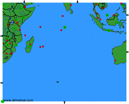
To change the map : click on the green buttons with a black cross to zoom in, on the green button with a dash to zoom out, or on the green arrows for adjacent maps.