METAR-TAF
Airports :
Dayton
Adrian
Akron–Canton
Akron-Fulton
Anderson
Angola
Ann Arbor
Ashland
Ashtabula
Athens
Auburn
Battle Creek
Beaver Falls
Beckley
Bellefontaine
Benton Harbor
Blacksburg
Bloomington
Bluefield
Bowling Green
Buckhannon
Carmi
Charleston
Charlotte
Chatham-Kent
Chicago
Chicago-Midway
Cincinnati
Clarksburg
Cleveland
Cleveland-Burke-Lakefront
Coldwater
Columbus
Columbus-Bolton
Columbus-John Glenn
Columbus-OSU
Columbus-Rickenbacker
Covington
Crawfordsville
Cuyahoga County
Danville
Danville
Dayton
Dayton
Dayton
Defiance
Delaware
Detroit
Detroit
Detroit
Detroit / Grosse Ile
Dublin
Elkhart
Erieau
Evansville
Findlay
Flemingsburg
Flint
Fort Knox
Fort Wayne
Frankfort
Galax / Hillsville
Gary
Glasgow
Goshen
Grand Rapids
Hamilton
Henderson
Hillsdale
Holland
Howell
Huntington
Indianapolis
Indianapolis
Indianapolis
Indianapolis
Jackson
Jackson
Jasper County
Joliet
Kalamazoo / Battle Creek
Kankakee
Kenosha
Kokomo
Lafayette
Lambertville
Lancaster
Lansing
Lansing
Lawrenceville
Lewisburg
Lexington
Lima
London
London
Lorain / Elyria
Louisville
Louisville
Madison
Mansfield
Marion
Marion / Wytheville
Marshall
Mason
Meadville
Milwaukee
Monroe
Monticello
Mount Carmel
Mount Clemens
Muncie
Newark
New Castle
New Philadelphia
Norfolk County
Olney-Noble
Owensboro
Owosso
Paris
Parkersburg
Peru
Pikeville
Pineville
Pittsburgh
Pontiac
Port Huron
Racine
Rantoul
Robinson
Romeoville
Sarnia
Shelbyville
Somerset
South Bend
South Haven
Springfield
Sturgis
Terre Haute
Toledo
Toledo
Troy
Valparaiso
Versailles
Wapakoneta
Warsaw
Washington
Washington
Waukegan
Wheeling
Wheeling / Prospect Heights
Willoughby
Wilmington
Windsor
Wise
Wooster
Youngstown / Warren
Zanesville
Indiana, Ohio
Delaware
Illinois
Indiana
Kentucky
Maryland
Michigan
New York
North America
Ontario, South
Pennsylvania
Tennessee
Virginia
Wisconsin
Dayton International Airport Dayton, Ohio, United States
latitude: 39-54-22N, longitude: 084-13-07W, elevation: 307 m
Current weather observation The report was made 12 minutes ago, at 14:09 UTC
Wind 3 kt from the West
Temperature 21 °C
Humidity 88 %
Pressure 1007 hPa
Visibility: 16.1 km
Few clouds at a height of 1200 ft Broken clouds at a height of 2000 ft Overcast at a height of 5500 ft
light rain
METAR: KDAY 021409Z 28003KT 10SM -RA FEW012 BKN020 OVC055 21/19 A2974 RMK AO2 RAB02 P0000 T02110194 $
Time: 10:21 (14:21 UTC) Forecast The report was made 2 hours and 59 minutes ago, at 11:22 UTC
Forecast valid from 02 at 12 UTC to 03 at 12 UTC
Wind 4 kt from the South/Southwest
Visibility: 10 km
Scattered clouds at a height of 400 ft Scattered clouds at a height of 2500 ft
From 02 at 1400 UTC
Wind 4 kt from the South/Southwest
Visibility: 10 km
Broken clouds at a height of 1500 ft
From 02 at 1700 UTC
Wind 5 kt from the West/Southwest
Visibility: 10 km
Scattered clouds at a height of 2500 ft Broken clouds at a height of 3500 ft
Temporary
Wind 6 kt from the North/Northwest
Broken clouds at a height of 2500 ft
light rain showers
From 02 at 2300 UTC
Wind 7 kt from the North/Northwest
Visibility: 10 km
Broken clouds at a height of 1800 ft
Temporary
Visibility: 8.0 km
Overcast at a height of 800 ft
mist
TAF: KDAY 021122Z 0212/0312 20004KT P6SM SCT004 SCT025 FM021400 20004KT P6SM BKN015 FM021700 25005KT P6SM SCT025 BKN035 TEMPO 0219/0223 33006KT -SHRA BKN025 FM022300 33007KT P6SM BKN018 TEMPO 0310/0312 5SM BR OVC008
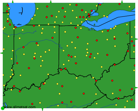
Weather observations and forecasts of more than 4000 airports (METAR and TAF reports).
The available stations are represented by yellow and red dots on the map.
Hover mouse over dot to see the name of the station.
Then click to see weather observations and forecasts.
To change the map : click on the green buttons with a black cross to zoom in, on the green button with a dash to zoom out, or on the green arrows for adjacent maps.