METAR-TAF
Airports :
Rochester
Albert Lea
Algona
Ames
Ankeny
Antigo
Appleton
Atlantic
Audubon
Austin
Baraboo / Wisconsin Dells
Beatrice
Benson
Black River Falls
Boone
Boscobel
Buffalo
Burlington
Camp Douglas
Carroll
Cedar Rapids
Chariton
Charles City
Cherokee
Chillicothe
Clarinda
Clarion
Clinton
Council Bluffs
Creston
Davenport
Decorah
Denison
Des Moines
Dodge Center
Dubuque
Eau Claire
Estherville
Fairfield
Fairmont
Falls City
Faribault
Forest City
Fort Dodge
Fort Madison
Fort Riley
Freeport
Fremont
Galesburg
Glencoe
Granite Falls
Grinnell
Hannibal
Harlan
Hutchinson
Independence
Iowa City
Jackson
Jacksonville
Janesville
Kansas City
Kansas City
Keokuk
Kirksville
Knoxville
Lacon
La Crosse
Lamoni
Lawrence
Le Mars
Lincoln
Lincoln
Litchfield
Litchfield
Lone Rock
Luverne
Macomb
Madison
Madison
Manhattan
Mankato
Maple Lake
Marshall
Marshall
Marshalltown
Marshfield
Mason City
Medford
Menomonie
Merrill
Mineral Point
Minneapolis
Minneapolis / Blaine
Minneapolis / Crystal
Minneapolis / Eden Prairie
Minneapolis / Lakeville
Moline
Monroe
Montevideo
Monticello
Mosinee
Mount Pleasant
Muscatine
Nebraska City
New Richmond
Newton
New Ulm
Oelwein
Olivia
Omaha
Omaha
Omaha
Orange City
Ortonville
Osceola
Ottumwa
Owatonna
Pella
Peoria
Peru / LaSalle
Pipestone
Pittsfield
Platteville
Prairie du Chien
Preston
Quincy
Red Oak
Red Wing
Redwood Falls
Rochelle
Rochester
Rockford
Saint Joseph
Saint Paul
Savanna
Sheldon
Shenandoah
Sioux City
Sioux Falls
South St. Paul
Sparta
Spencer
Springfield
Stanton
Sterling / Rock Falls
Stevens Point
St. James
Storm Lake
Taylorville
Tekamah
Topeka
Vinton
Wahoo
Waseca
Washington
Waterloo
Waupaca
Wausau
Webster City
Willmar
Windom
Winona
Wisconsin Rapids
Worthington
Iowa
Dakota
Illinois
Indiana
Kansas
Minnesota
Missouri
Nebraska
North America
Wisconsin
Rochester International Airport Rochester, Minnesota, United States
latitude: 43-54-15N, longitude: 092-29-30W, elevation: 1315 ft
Current weather observation The report was made 21 minutes ago, at 14:54 UTC
Calm wind
Temperature 73 °F
Humidity 73 %
Pressure 29.94 in. Hg
Visibility: 6 miles
Clear sky
haze
METAR: KRST 281454Z 00000KT 6SM HZ CLR 23/18 A2994 RMK AO2 SLP130 T02330178 53009
Time: 10:15 (15:15 UTC) Forecast The report was made 3 hours and 55 minutes ago, at 11:20 UTC
Forecast valid from 28 at 12 UTC to 29 at 12 UTC
Wind 10 mph from the Northeast
Visibility: 6 miles
Scattered clouds at a height of 25000 ft
From 28 at 1800 UTC
Wind 7 mph from variable directions
Visibility: 6 miles
Few clouds at a height of 6000 ft Few clouds at a height of 25000 ft
TAF: KRST 281120Z 2812/2912 05009KT P6SM SCT250 FM281800 VRB06KT P6SM FEW060 FEW250
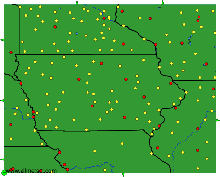
Weather observations and forecasts of more than 4000 airports (METAR and TAF reports).
The available stations are represented by yellow and red dots on the map.
Hover mouse over dot to see the name of the station.
Then click to see weather observations and forecasts.
To change the map : click on the green buttons with a black cross to zoom in, on the green button with a dash to zoom out, or on the green arrows for adjacent maps.