METAR-TAF
Airports :
Mardin Airport
Mardin, Turkey
latitude: 37-13-58N, longitude: 40-38-26E, elevation: 527 m
Current weather observation
The report was made 5 hours and 42 minutes ago, at 19:50 UTC
Wind 7 kt from the East/Southeast, varying between East and South
Temperature 24°C
Humidity 36%
Pressure 1009 hPa
Visibility 10 km or more
Scattered clouds at a height of 3500 ft
Broken clouds at a height of 10000 ft
Broken clouds at a height of 10000 ft
METAR: LTCR 111950Z 12007KT 100V170 9999 SCT035 BKN100 24/08 Q1009 RETSRA
Time: 04:32 (01:32 UTC)
Forecast
The report was made 6 hours and 25 minutes ago, at 19:07 UTC
Forecast valid from 11 at 19 UTC to 11 at 24 UTC
Wind 14 kt from the Northwest
Visibility 10 km or more
Few clouds at a height of 4000 ft
Broken clouds at a height of 10000 ft
Broken clouds at a height of 10000 ft
Temporary
from 11 at 19 UTC to 11 at 23 UTC
from 11 at 19 UTC to 11 at 23 UTC
Few clouds at a height of 2500 ft, Cumulonimbus.
Broken clouds at a height of 3500 ft
Broken clouds at a height of 3500 ft
thunderstorm, light rain,
TAF: LTCR 111907Z 1119/1124 32014KT 9999 FEW040 BKN100 TEMPO 1119/1123 -TSRA FEW025CB BKN035
Weather observations and forecasts of more than 4000 airports (METAR and TAF reports).
The available stations are represented by yellow and red dots on the map.
Hover mouse over dot to see the name of the station.
Then click to see weather observations and forecasts.
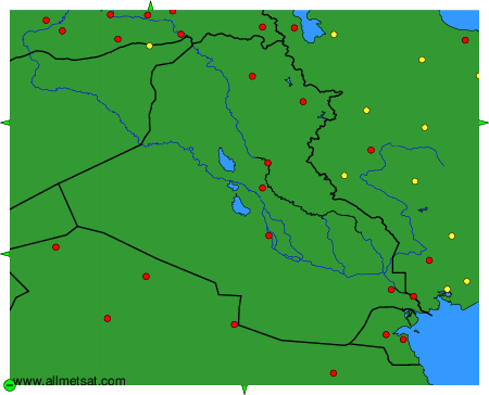
To change the map : click on the green buttons with a black cross to zoom in, on the green button with a dash to zoom out, or on the green arrows for adjacent maps.