METAR-TAF
Airports :
Rafha Domestic Airport
Rafha, Saudi Arabia
latitude: 29-37N, longitude: 043-29E, elevation: 449 m
Current weather observation
The report was made 14 minutes ago, at 05:00 UTC
Wind 10 kt from the West
Temperature 30°C
Humidity 14%
Pressure 1006 hPa
Visibility 10 km or more
no clouds below 1500 m and no cumulonimbus
METAR: OERF 120500Z 26010KT CAVOK 30/00 Q1006 NOSIG
Time: 08:14 (05:14 UTC)
Forecast
The report was made 1 hour and 44 minutes ago, at 03:30 UTC
Forecast valid from 12 at 04 UTC to 13 at 06 UTC
Wind 13 kt from the West
Visibility: 7000 m
Becoming
from 12 at 18 UTC to 12 at 20 UTC
from 12 at 18 UTC to 12 at 20 UTC
Wind 3 kt from variable directions
Becoming
from 13 at 04 UTC to 13 at 06 UTC
from 13 at 04 UTC to 13 at 06 UTC
Wind 14 kt from the West
TAF: OERF 120330Z 1204/1306 27013KT 7000 NSC BECMG 1218/1220 VRB03KT BECMG 1304/1306 28014KT
Weather observations and forecasts of more than 4000 airports (METAR and TAF reports).
The available stations are represented by yellow and red dots on the map.
Hover mouse over dot to see the name of the station.
Then click to see weather observations and forecasts.
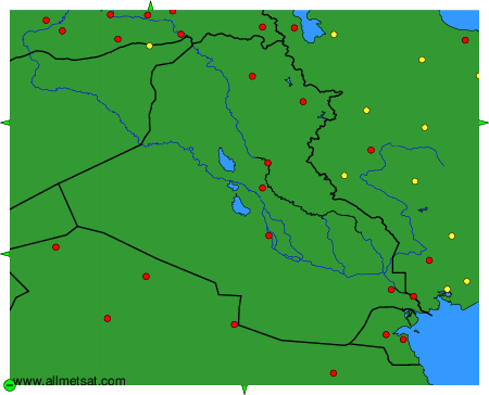
To change the map : click on the green buttons with a black cross to zoom in, on the green button with a dash to zoom out, or on the green arrows for adjacent maps.