METAR-TAF
Airports :
Ahvaz International Airport
Ahvaz, Iran
latitude: 31-20N, longitude: 048-40E, elevation: 20 m
Current weather observation
The report was made 27 minutes ago, at 04:30 UTC
Wind 6 kt from the South
Temperature 30°C
Humidity 49%
Pressure 1004 hPa
Visibility 10 km or more
no clouds below 1500 m and no cumulonimbus
METAR: OIAW 120430Z 18006KT CAVOK 30/18 Q1004
Time: 09:27 (04:57 UTC)
Forecast
The report was made 5 hours and 57 minutes ago, at 23:00 UTC
Forecast valid from 12 at 00 UTC to 13 at 06 UTC
Wind 7 kt from the East/Southeast
Visibility 10 km or more
no clouds below 1500 m and no cumulonimbus
Temporary
from 12 at 00 UTC to 12 at 07 UTC
from 12 at 00 UTC to 12 at 07 UTC
Visibility: 3000 m
haze
Temporary
from 12 at 09 UTC to 12 at 16 UTC
from 12 at 09 UTC to 12 at 16 UTC
Wind 18 kt from the South/Southeast
Visibility: 4000 m
Few clouds at a height of 3500 ft, Towering cumulus.
Probability 40% :
Temporary
from 13 at 00 UTC to 13 at 06 UTC
from 13 at 00 UTC to 13 at 06 UTC
Visibility: 3000 m
haze,
TAF: OIAW 112300Z 1200/1306 12007KT CAVOK TEMPO 1200/1207 3000 HZ TEMPO 1209/1216 16018KT 4000 DU/SA FEW035TCU PROB40 TEMPO 1300/1306 3000 HZ
Weather observations and forecasts of more than 4000 airports (METAR and TAF reports).
The available stations are represented by yellow and red dots on the map.
Hover mouse over dot to see the name of the station.
Then click to see weather observations and forecasts.
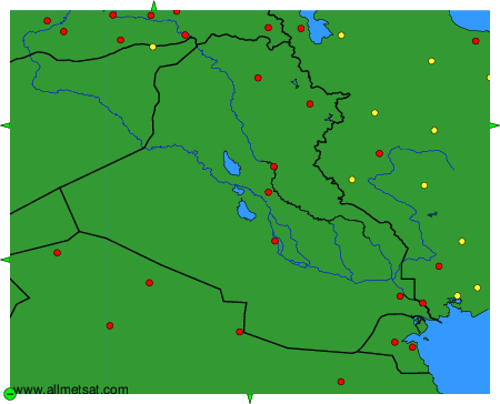
To change the map : click on the green buttons with a black cross to zoom in, on the green button with a dash to zoom out, or on the green arrows for adjacent maps.